 Abraham Lincoln
If given the truth, the people can be depended upon to meet any national crisis...
 Guildford news...
for Guildford people, brought to you by Guildford reporters - Guildford's own news service
Where Is This? No.19
Published on: 30 Jul, 2012
Updated on: 30 Jul, 2012
By David Rose
 Well done to all of you who had no trouble spotting last week’s mystery photo as the bottom of North Street near the junction with Friary Street (just out of view). The shops have long gone and today it is the delivery entrance and path to Phoenix Court.
Click here to read all the replies to last week’s poser that appear at the foot of the post.
And the mystery date appears on the Onslow Bridge in Bridge Street. Again, another one that was quite easily recognised. The picture here shows the sign along with some more of the bridge’s iron work.
Interesting to think that as that bridge was not opened until 1882, for nearly 40 years all the traffic to and from the railway station (opened in 1845) would have had to have gone down Farnham Road and Park Street and over the Town Bridge to get into the centre of Guildford. See, it took them a long time back then to sort out traffic problems!
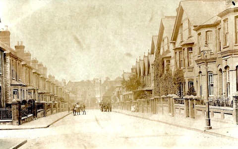
This week’s mystery picture is a cracker as far as I am concerned and it is reproduced from an old ‘real photograph’ picture postcard that I had not seen before.
It is pasted into one of a number of scrapbooks I have been looking at and copying items from, that belong to Fred Smith of Guildford. His late father compiled the scrapbooks in the first decades of the 20th century. They are packed with press cuttings and vintage photos.
This postcard does not have a caption printed on it, so I can’t be sure of the location. But I think I have an idea as I have enlarged it on my computer screen and I recognise the buildings facing at the far end of the street seen here.
The buildings in the street itself remain, but the ones in the road in the background have gone. As a clue, I think it’s fair to say that it’s a street not too far from the former cattle market.
The mystery date appears on a landmark building. Cropping it in as I have done may make it a little harder to recognise, but take Courage when you send your reply!
If you think you know the answers, leave a reply in the box below. All replies will be posted at the same time in about a week’s time, along with a new post with the answers to this week’s photo and mystery date, and the next pair of images.
Responses to Where Is This? No.19
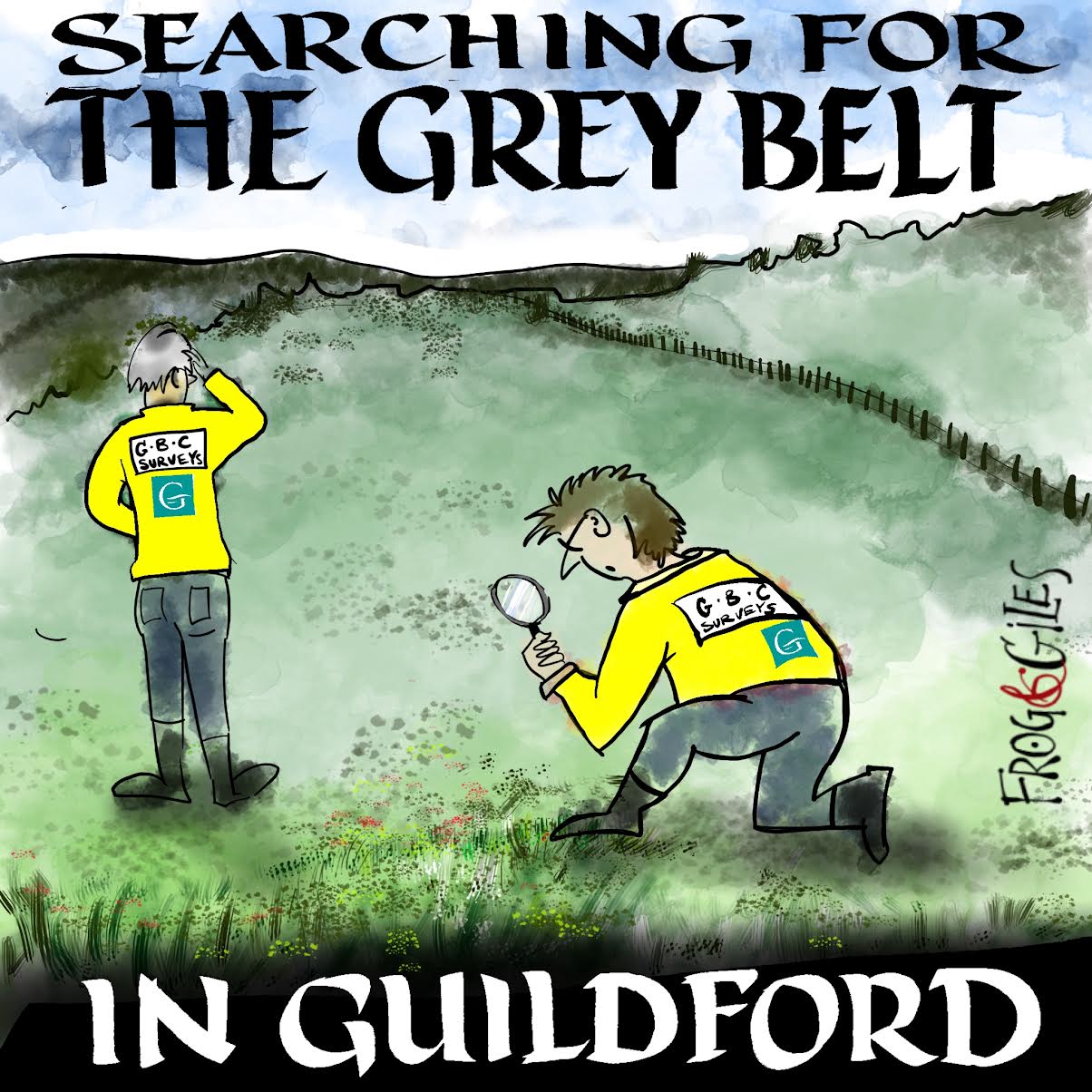
"Found any?" - "Nope, it all looks green to me!" (See Opinion: The Future is Congested, the Future is Grey)
www.abbotshospital.org/news/">


Recent Articles
- Firework Fiesta: Guildford Lions Club Announces Extra Attractions
- Come and Meet the Flower Fairies at Watts Gallery
- Royal Mail Public Counter in Woodbridge Meadows to Close, Says Staff Member
- Latest Evidence in Sara Sharif Trial
- Letter: New Developments Should Benefit Local People
- Open Letter to Jeremy Hunt, MP: Ash’s Healthcare Concerns
- Opinion: The Future is Congested, the Future is Grey
- Full Match Report: City Go Out of FA Vase on Penalties
- Letter: Incinerating Unnecessary Packaging Causes Pollution
- Letter: Thank You, Royal Surrey


Recent Comments
- David Chave on Did You See Punk Band The Clash At Guildford Civic Hall in 1977?
- Olly Azad on Full Match Report: City Go Out of FA Vase on Penalties
- Ben Paton on Opinion: The Future is Congested, the Future is Grey
- N Rockliff on G Live Brings More Classical Concerts to Guildford from Renowned Orchestras
- Paul Duggen on Woking Councillors Refuse School Expansion Proposal
- Susan Smith on Birdwatcher’s Diary No.314
Search in Site
Media Gallery
Dragon Interview: Local Artist Leaves Her Mark At One of England’s Most Historic Buildings
January 21, 2023 / No Comment / Read MoreDragon Interview: Lib Dem Planning Chair: ‘Current Policy Doesn’t Work for Local People’
January 19, 2023 / No Comment / Read MoreA3 Tunnel in Guildford ‘Necessary’ for New Homes, Says Guildford’s MP
January 10, 2023 / No Comment / Read More‘Madness’ for London Road Scheme to Go Ahead Against ‘Huge Opposition’, Says SCC Leader
January 6, 2023 / No Comment / Read MoreCouncillor’s Son Starts Campaign for More Consultation on North Street Plan
December 30, 2022 / No Comment / Read MoreCounty Council Climbs Down Over London Road Works – Further ‘Engagement’ Period Announced
December 14, 2022 / No Comment / Read MoreDragon Interview: GBC Reaction to the Government’s Expected Decision to Relax Housing Targets
December 7, 2022 / No Comment / Read MoreHow Can Our Town Centre Businesses Recover? Watch the Shop Front Debate
May 18, 2020 / No Comment / Read More




Bernard Parke
July 30, 2012 at 9:14 pm
1) Could be Church Road looking towards Woodbridge Road. The buildings at the end could be Wellington Place which had the date 1851 under the name of the central building.
2)The Wooden Bridge pub at the bottom of Woodbridge Hill. Caused at lot of raised eye brows when it was built.
Ray Springer
July 31, 2012 at 6:32 pm
Tricky one this week, but think it might be Artillery Road.
The sign of 1936 is on the Wooden Bridge pub – been there several times !!!
Karen Fredborg
July 31, 2012 at 9:58 pm
The street is Artillery Road.
Caroline Reeves
August 1, 2012 at 12:18 pm
The street is Artillery Road, looking down from Artillery Terrace. Thank you David, I have been looking for a photo of the road for the last 25 years! Interesting that the incline is much more noticeable when there are no cars – if only it could be like that again.
Caroline
David & Ann bailey
August 3, 2012 at 6:05 pm
The picture is of Artillery Road, looking towards Woodbridge Road
Chris Townsend
August 6, 2012 at 7:34 am
The street is Artillery Road, by the corner of Artillery Terrace.
Chris Townsend
August 6, 2012 at 8:06 am
I think the date is on The Wooden Bridge – certainly it’s a landmark!