 Abraham Lincoln
If given the truth, the people can be depended upon to meet any national crisis...
 Guildford news...
for Guildford people, brought to you by Guildford reporters - Guildford's own news service
Where Is This? No.229
Published on: 6 Oct, 2016
Updated on: 6 Oct, 2016
By David Rose
Plenty of replies to last week’s mysteries – correctly identifying the locations and with various suggestions as to where I actually stood to take the quirky picture.
To begin with, the vintage picture of a rowing four was taken not far from Guildford Rowing Club’s boathouse, just downstream, with Shalford Road and the Great Quarry behind.
And the young chap among the crew being none other than alderman Bernard Parke. Over an excellent lunch at Guildford’s County Club on Monday (many thanks to him) I persuaded him to add reply, which he has done, with some extra details about his rowing days.
Of the quirky picture, many correctly identified the now named Cardwells Keep, formerly the keep of Stoughton Barracks, and the sprawl of Woking town centre as being in view.
I took the picture using the full zoom on my Lumix (Panasonic) bridge camera from a gap I spied from about Powell Close in Onslow Village – that’s near the recreation ground and just behind the parade of shops in The Square.
Some suggested The Mount as the location. That would have taken me higher up and I don’t think the view would have compressed Stoughton in the foreground and Woking town centre in the distance so well.
The recent housing development of the former Stoughton Barracks and Cardwells Keep is so named after 1st Viscount Edward Cardwell, a 19th century politician, who, when Secretary of State for War (1868-1874), made a number of reforms to the British Army. It was during his time that regiments were reformed on a county basis, so I believe. More about him on Wikipedia here. I have also read that he lived at Eashing, near Godalming.
Click here to see last week’s post and all the replies.
Here are this week’s mysteries.
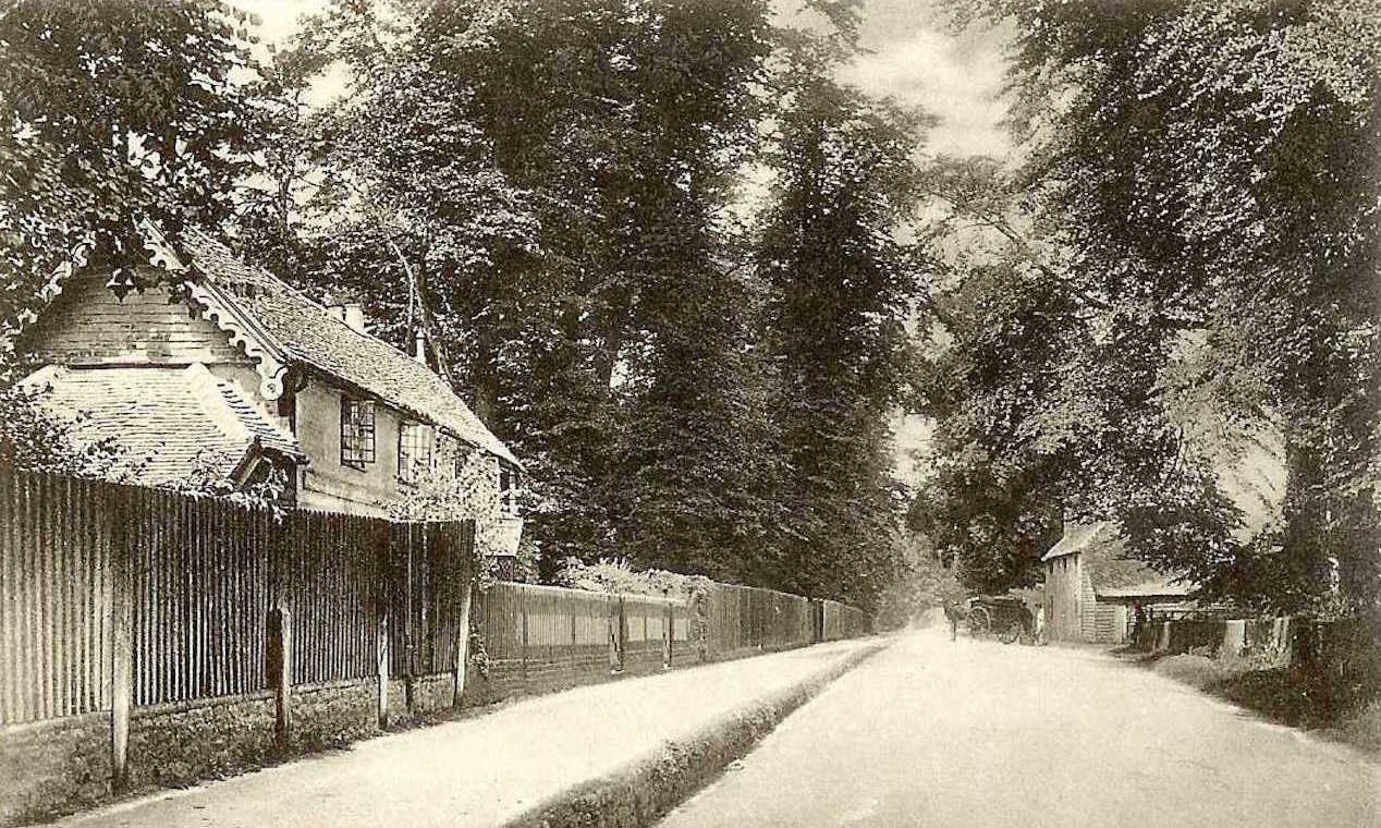
When comparing views of yesteryear to today, in some instances it is apparent that there are a lot more trees and bushes now than there were years ago. However, this week’s mystery vintage picture bucks that trend as in this view there are more trees along this road than there are today.
The cottages seen on the left still stand, but the one seen on the right has long gone. However, it was once an important building. Think back to the days of the road network before the coming of the railways.
The view is not too far from Guildford town centre and is looking towards the town. Do you know where it is?
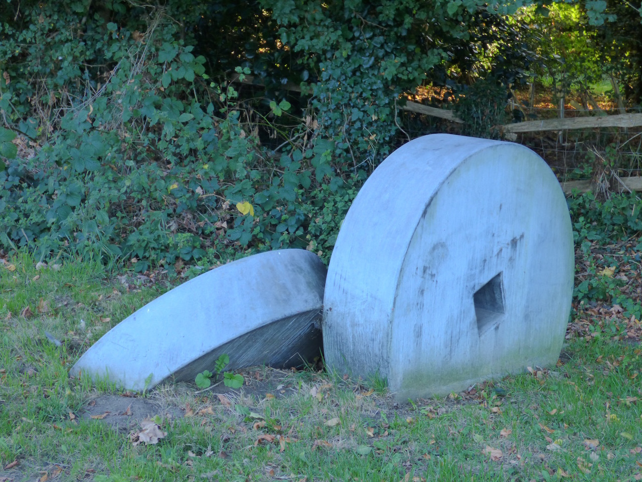
This week’s quirky picture features some mock mill stones, a couple of miles from Guildford and represent a once important ‘works’ hereabouts.
There are a number of these features close to where the ‘works’ in question was. These are on a tight bend of a road that leads through a village. Do you know where?
If you know the answers to this week’s mysteries, please leave a reply in the box below – and include extra details if you have them.
They will be published along with two more mystery images at about the same time next week. Good luck.
Responses to Where Is This? No.229
Leave a Comment Cancel replyPlease see our comments policy. All comments are moderated and may take time to appear. Full names, or at least initial and surname, must be given.
Recent Articles
- Opinion: We Should Restore Clandon House
- Police Operation Puts Drug Gang Members Behind Bars
- Letter: Report on Councils’ Collaboration Benefits Has Been Over-hyped
- Council Tenants Unhappy With the Way GBC Handles Their Complaints
- Declaration Marks 750th Anniversary of a ‘Dark Day in Guildford’s History’
- Letter: For Democracy to Work We Need to Engage
- Reported Council Collaboration Savings Contested By Opposition Councillors
- Suspect Arrested Following Collision with Pedestrian in Guildford
- Notice: Free Valuation of Stamps, Coins, Trading Cards and Gold, January 29
- Witness Appeal Following Serious Collision


Recent Comments
- Michael Foster on Regulator Finds ‘Serious Failings’ in GBC’s Council Housing Safety Compliance
- Dave Middleton on Council Tenants Unhappy With the Way GBC Handles Their Complaints
- Jane Austin on Reported Council Collaboration Savings Contested By Opposition Councillors
- Andrew Few on Memories Of The Young Eric Clapton at Guildford’s Harvest Moon Club
- George Potter on Reported Council Collaboration Savings Contested By Opposition Councillors
- Mike Smith on Surrey Councils Call on Residents to Recycle All Their Food Waste
Search in Site
Media Gallery
Dragon Interview: Local Artist Leaves Her Mark At One of England’s Most Historic Buildings
January 21, 2023 / No Comment / Read MoreDragon Interview: Lib Dem Planning Chair: ‘Current Policy Doesn’t Work for Local People’
January 19, 2023 / No Comment / Read MoreA3 Tunnel in Guildford ‘Necessary’ for New Homes, Says Guildford’s MP
January 10, 2023 / No Comment / Read More‘Madness’ for London Road Scheme to Go Ahead Against ‘Huge Opposition’, Says SCC Leader
January 6, 2023 / No Comment / Read MoreCouncillor’s Son Starts Campaign for More Consultation on North Street Plan
December 30, 2022 / No Comment / Read MoreCounty Council Climbs Down Over London Road Works – Further ‘Engagement’ Period Announced
December 14, 2022 / No Comment / Read MoreDragon Interview: GBC Reaction to the Government’s Expected Decision to Relax Housing Targets
December 7, 2022 / No Comment / Read MoreHow Can Our Town Centre Businesses Recover? Watch the Shop Front Debate
May 18, 2020 / No Comment / Read More


Dave Middleton
October 6, 2016 at 11:31 am
The Old cottages are Park Cottages, on the A281 Shalford Road, on the left, just before the junction with Pilgrim’s Way as you approach Guildford from the south.
The building on the right was the Shalford Road toll house, which survived until 1933 when the junction of Shalford Road and Pilgrims’ Way was improved and the Shalford Road was widened.
Roadside toll houses were common once upon a time and the tolls collected were used by the various towns and parishes to improve the roads and sometimes to fund relief for the parish poor.
The “millstones” are at Chilworth, at the junction of New Road and Hornhatch Lane and relate to the Chilworth Gunpowder Mills.
Mary Redgwell
October 7, 2016 at 11:43 am
The millstones are at the Chilworth Gunpowder site.
Margaret Cole
October 11, 2016 at 9:15 am
I think this is Park Cottages Shalford Road, opposite Pilgrims’ Way.
The Mill stones can be found at the Hornhatch Estate corner at Chilworth.
They represent the gunpowder works from the old factory off Blacksmiths Lane where the Tillingborne stream runs, and which carried the gunpowder through to Shalford Wharf and Dapdune Wharf en route to London in the late 1800s for munitions.
Brian Holt
October 11, 2016 at 2:14 pm
The toll-keeper’s cottage Shalford Road. It was pulled down in the 1930s for road widening and for the entrance to Pilgrims’ Way.
The mill stones are on the corner of Dorking Road and Blacksmith Lane and Chilworth Gunpowder Mill was down the lane.
Chris Townsend
October 11, 2016 at 6:02 pm
The vintage picture shows Shalford Road, with Park Cottages on the left, which survived being badly damaged by a falling tree during the Great Storm of 1906.
The building on the right was a toll cottage, on the turnpiked road from Dapdune Wharf to Alfold Bars, through Shalford and Bramley, past another which once stood on the frontage of the former Leathern Bottle pub. The road ceased to be turnpiked in the 1870s.
The mill stones must be reminders of the old Gunpowder Works at Chilworth, off Blacksmiths Lane. There are tight bends both sides of the level crossing on the main road, but I haven’t yet seen the stones in the photo.
Bill and Doug Stanniforth
October 12, 2016 at 9:06 am
Picture 1 is Park Cottages opposite Pilgrims’ Way by Shalford Park. By the information given we presume this was a toll house for a turnpike road. Canny traders would have of course used their boats on the river.
Picture 2 are the millstones on the corner of New Road and Hornhatch in Chilworth. This point to the gunpowder works on the mighty Tillingbourne. We notice the cameraman’s fancy equipment didn’t manage to get the millstones in Halfpenny Lane and near Boundary Cottages in Albury in the same picture.