 Abraham Lincoln
If given the truth, the people can be depended upon to meet any national crisis...
 Guildford news...
for Guildford people, brought to you by Guildford reporters - Guildford's own news service
Letter: A Model Way We Could All See What Our Town’s Future Looks Like In Planning
Published on: 17 Jun, 2020
Updated on: 21 Jun, 2020
From Bill Stokoe
chairman, Guildford Vision Group
Even before lockdown’s legacy, our town and its centre faces challenges. Among these are large developments that will shape the future of our town, for good or bad. But do we know what they might look like? What mass, height and cladding choices are there, for example? How might residents better see what is going on?
The list of developments includes very large schemes: Solum at the station, North Street, Bedford Square, The Casino, Guildford Park Road, Bright Hill, Cathedral housing, Weyside Urban Village (previously known as Slyfield Regeneration), Bright Hill, large housing schemes along Walnut Tree Close with the Debenhams site surely to follow. And there’s the major housing schemes at Blackwell Farm, Gosden Hill Farm and Garlick’s Arch, as well as Wisley Airfield.
How might residents get a better view of potential developments? When a formal planning application emerges, it is often hard for the untutored to visualize the scheme in its context.
But in these digital days, it possible to have a reasonably lifelike 3D model of our town. Such modelling has been possible for some time. Our council has yet to embrace it. The latest excuse is, of course, the depredations to the council budget, courtesy of Covid-19.
GVG, helped by architects on our Working Group, has been quietly promoting the use of digital modelling to the council over the past year. Our group concluded one particular firm of modellers was worth consideration. GVG approached the council at high level and approval was given to set up a demonstration. A planning officer attended the demonstration in London. Sadly, shortly afterwards, the officer was let go.
At one stage, we were given to understand the council would move ahead. Then all went quiet for a few more months.
In our latest attempt, the council reply (from an officer) included the following: “GBC Planning Team, whilst appreciating the benefits of such a system, expect parties who make planning applications to provide views along with the application and these are made in the format of a CGI or a similar format to what [modelling company] offers.”
The modelling company through which GVG organised the demo acts for 25 out of the 32 London boroughs, including the City of London. The company also acts for Woking, Belfast, Cambridge and Salford councils, plus TfL and Historic England among others.
One of the most potent features of the demonstration was the ability to see a development in its almost real-time setting, viewable from any direction and height. You could even see its shadow cast, by the hour and season, and its impact on the skyline and adjoining roofscapes.
All this uses commonplace architectural software packages that allow cutting and pasting into the present built environment. Crucially, the modelling software then allows “what ifs”. It also allows quick and easy insertion of alternative scheme options, including façade treatment. This is all by instant keystroke and mouse manipulation.
Think how such software could help the Planning Committee in its deliberations.
Basic manipulation of the 3D model is possible by the untrained. Thus the town model could be displayed on a screen in the Millmead foyer where visitors could see how a large development might look from a variety of viewpoints and heights. We did just that in the modellers’ foyer where there’s a comprehensive model of London.
The cost? From about £50,000 to set up (it starts with an aerial survey of £5k-£8k) and £1,000 per month to run. Cheap at the price, I’d say, Covid-19 notwithstanding. Especially when all the developments above are mega-millions.
So what should we at GVG do now? Press on or give up? What’s best for our town?
Responses to Letter: A Model Way We Could All See What Our Town’s Future Looks Like In Planning
Leave a Comment Cancel replyPlease see our comments policy. All comments are moderated and may take time to appear.
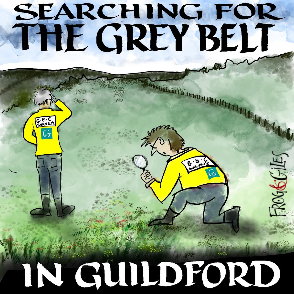
"Found any?" - "Nope, it all looks green to me!" (See Opinion: The Future is Congested, the Future is Grey)
www.abbotshospital.org/news/">


Recent Articles
- Latest Evidence in Sara Sharif Trial
- Ash’s New Road Bridge Is Named – and November 23rd Is Opening Day
- Class A in Underwear Leads to Jail Sentence
- Historical Almshouse Charity Celebrates Guildford in Bloom Victory
- Notice: Shalford Renewable Showcase – November 16
- Firework Fiesta: Guildford Lions Club Announces Extra Attractions
- Come and Meet the Flower Fairies at Watts Gallery
- Updated: Royal Mail Public Counter in Woodbridge Meadows to Close, Says Staff Member
- Letter: New Developments Should Benefit Local People
- Open Letter to Jeremy Hunt, MP: Ash’s Healthcare Concerns


Recent Comments
- Paul Spooner on Ash’s New Road Bridge Is Named – and November 23rd Is Opening Day
- Harry Eve on Opinion: The Future is Congested, the Future is Grey
- Nigel Keane on Letter: New Developments Should Benefit Local People
- Nathan Cassidy on Updated: Royal Mail Public Counter in Woodbridge Meadows to Close, Says Staff Member
- T Saunders on Opinion: The Future is Congested, the Future is Grey
- Jim Allen on Updated: Royal Mail Public Counter in Woodbridge Meadows to Close, Says Staff Member
Search in Site
Media Gallery
Dragon Interview: Local Artist Leaves Her Mark At One of England’s Most Historic Buildings
January 21, 2023 / No Comment / Read MoreDragon Interview: Lib Dem Planning Chair: ‘Current Policy Doesn’t Work for Local People’
January 19, 2023 / No Comment / Read MoreA3 Tunnel in Guildford ‘Necessary’ for New Homes, Says Guildford’s MP
January 10, 2023 / No Comment / Read More‘Madness’ for London Road Scheme to Go Ahead Against ‘Huge Opposition’, Says SCC Leader
January 6, 2023 / No Comment / Read MoreCouncillor’s Son Starts Campaign for More Consultation on North Street Plan
December 30, 2022 / No Comment / Read MoreCounty Council Climbs Down Over London Road Works – Further ‘Engagement’ Period Announced
December 14, 2022 / No Comment / Read MoreDragon Interview: GBC Reaction to the Government’s Expected Decision to Relax Housing Targets
December 7, 2022 / No Comment / Read MoreHow Can Our Town Centre Businesses Recover? Watch the Shop Front Debate
May 18, 2020 / No Comment / Read More




Mike Forster
June 18, 2020 at 10:53 am
This sounds like a perfect way for residents to better appreciate what is being proposed and surely must be the way to proceed with the number of large new developments that are intended.
Annie Cross
June 19, 2020 at 10:24 am
What an excellent proposal. 3D images would provide images and perspectives that 2D images cannot. Planning can be controversial so visualising projects and their context is a sensible way to make good planning decisions.
Barbara Ford
June 28, 2020 at 10:44 am
This should be particularly relevant in a town like ours with some quite steep hills, so that many developments are in the normal course of things seen from above as well as from the sides.
Bob Bromham
July 1, 2020 at 12:22 pm
A word of caution about the use of programmes like this. Of course, perspective presentation of schemes can be a help in understanding spatial connections, but the essential, and enforceable, definition of schemes can only be through 2D drawings such as plans, elevations and sections.
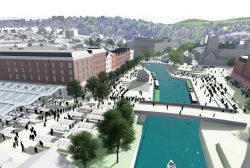
It is rather patronising to suggest that the public are not capable of interpreting these. Video and “3D” presentations are mostly used for promotion of developments, as GVG have, and always portray the scheme in the most attractive and often misleading way – sun always shining, glowing blue rivers, public areas thronged with busy people, perfectly proportioned trees (that rarely appear in the built scheme), wide-angle views that exaggerate spaciousness etc.
This does highlight a growing problem. I have now examined several thousand planning applications, and reviewed many draft policies to prepare for discussion by Holy Trinity Amenity Group. 20 years ago these were concise and fairly easy to handle. Now, with online handling and digitisation, many applications and draft policies are accompanied by voluminous documents aggressively promoting the proposals; ordinary members of the public cannot easily assess these. They will inevitably have some influence on planning officers, however hard they try to be objective.
So all these “presentations” need to be treated with caution and any conclusions must be based on definitive plans. It is the job of GBC to inform, not persuade, residents”
Bill Stokoe
July 2, 2020 at 2:29 pm
With the best will in the world, I can’t see that 20 years of resident groups and others reviewing plans and 2D drawings in a “traditional” way has produced much of a result for Guildford.
We have areas of the town that lie fallow, unproductive or misused, a mishmash of unexciting, unattractive and disconnected architectural styles, a Solum scheme where 2D plans didn’t forestall a dreadful planning outcome and a town centre where the car dominates rather than pedestrians. Oh, and a riverside that’s criminally underused.
Time for a change, say I.
Bill Stokoe is the chair of the Guildford Vision Group
Peter Coleman
July 3, 2020 at 1:34 pm
It is also the job of council officers to guide and encourage development proposals and review options at the early stages of design in order to try and achieve good design on behalf of the residents.
VU City’s modelling program is a tool to use to review options and is supplementary to traditional drawings. It is not intended to replace the formal drawings but is a tool to review schemes in their context and the impact they have on the surroundings.
I hope we can have more openness about using technology to assist development whilst leaving the 2D drawings for the formal stuff.
Peter Coleman is a member of RIBA