- Stay Connected

Socialize

 Abraham Lincoln
If given the truth, the people can be depended upon to meet any national crisis...
Abraham Lincoln
If given the truth, the people can be depended upon to meet any national crisis...

 Guildford news...
for Guildford people, brought to you by Guildford reporters - Guildford's own news service
Guildford news...
for Guildford people, brought to you by Guildford reporters - Guildford's own news service
Where is This? No.275
Published on: 29 Sep, 2017
Updated on: 3 Oct, 2017
By David Rose
The parade of shops at Fairlands was featured as the mystery vintage picture in the previous Where is This? post.
Most readers who replied were correct, but a couple of replies suggested it showed the shops in Stoughton Road, Bellfields.
The quirky picture of a roof top plant can be found on the Casino nightclub building in Onslow Street.
In his reply Dave Middleton commented on the Casino nightclub complex, built as an early cinema and important to Guildford’s history, saying: “It appears to be being allowed to fall into decay and disrepair…. Can nothing be done to save it from such a fate?”
Click here to see the post and all the replies.
Do you know where this is?
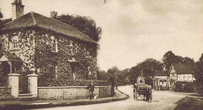
The mystery picture this time is another local village view published as a picture postcard in the early 1900s. As a clue, it’s in the neighbouring borough of Waverley.
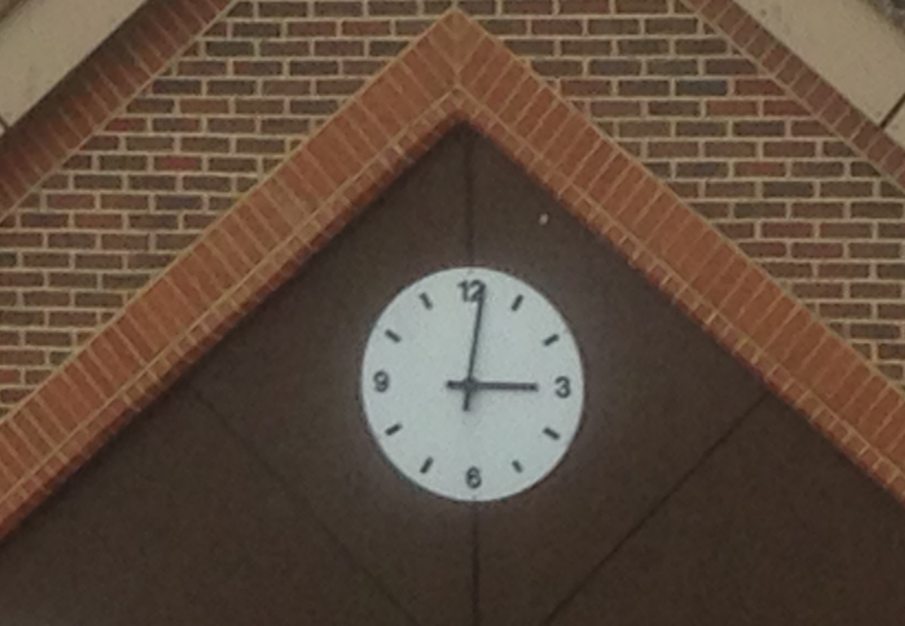
Where is this clock?
A clock this time for the quirky picture. The brickwork might help you recognise the building it is on, close to Guildford town centre.
If you think you know the answers, and may like to add some extra details as well, please leave a reply in the box below. The answers, along with the next pair of images, will be published in a couple of weeks.
Share This Post


Responses to Where is This? No.275
Leave a Comment Please see our comments policy. All comments are moderated and may take time to appear. Full names, or at least initial and surname, must be given.

I'm living well for nothing at all! (See: No Trifling Matter: Magpie Trapped in Godalming Sainsbury’s)


Next stop, Debt Chasm! (See: We Should All Be Outraged About the Failure to Deal with Legacy Debt)


John Lomas
September 23, 2017 at 4:55 pm
In the old picture the cart is practically on the mini roundabout in Milford at the start of Godalming Road.
The modern view shows the timbered building is still there though the creeper has been removed from what in the 1960s was called Hill House and was a surgery.
The squarish feature at, or just beyond, the timbered building is mirrored by the showrooms of the current Bedroom Craft showrooms.
https://goo.gl/maps/uBkcPGGwyEm
A possible choice for inclusion in a Milford / Godalming “Then and Now” book David?
J E Davey
September 24, 2017 at 10:08 pm
The old postcard picture is at Milford at the junction of Portsmouth Road and Church Road. The house, I think, is called Hill House, now minus the ivy covering plus a hedge in front.
The clock is above the entrance to the multi-storey car park on the old engine shed site in Farnham Road.
Chris Townsend
September 26, 2017 at 11:05 am
The village view is of the Portsmouth Road at Milford, looking towards Godalming (and what was the Red Lion, now Tesco) from the junction with Church Road and Station Lane. The cart seems to be an addition to the original photo.
The clock is above the vehicle entrance to Farnham Road Car Park.
Brian Holt
September 28, 2017 at 8:40 pm
In the late 1960s I use to deliver weekly to this house when driving for Guildford Laundry.
It was then Hill House, Portsmouth Road, Milford, looking towards Godalming with the Red Lion Pub on the right.
Dr Graham lived there and I think he must have also used it to see his patients, as I saw people going in and out, although I delivered to the back to back door.
The house is opposite the junction of Church Street, which is in the bottom of the picture on the right.
Warren Stores and Priorley’s the butchers were at that end of the Church Street in those days.
The clock is above the entrance to the Farnham Road multi-storey car park, built on the old engine shed site.