- Saturday, July 05, 2025
- Stay Connected
 Abraham Lincoln
If given the truth, the people can be depended upon to meet any national crisis...
 Guildford news...
for Guildford people, brought to you by Guildford reporters - Guildford's own news service
Where Is This? No.7
Published on: 4 May, 2012
Updated on: 4 May, 2012
By David Rose
Well done to Ian Plowman, Darrol Radley, and my old mate Simon Vine, who replied last week – they all knew the mystery date and the location of the vintage photo.
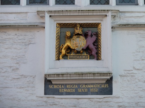
 Here’s a picture of the sign on the Royal Grammar School upon which the date of 1552 appears.
The location of the Angel, Son & Gray building was, of course, on the corner of Woodbridge Road and Onlsow Street.
Click here to see last week’s post again.
James Angel came to Guildford with his family in 1889 from Pembroke Dock in Wales and started an ironmongery business. It also had premises further along in Commercial Road and on the opposite side of Woodbridge Road. They all became a bit of landmark in the town.
The business sold all types of building materials and supplies. Last week’s photo showed the building that was known as “Angel’s Corner”. It was its modern showroom that covered 7,000 sq ft. When the Friary development took place at the end of the 1970s, Angels of Guildford moved to Mary Road. The company was taken over by the Wilky Group in 1982.
![]() Another mystery date again this week, courtesy of Richard Bailey. Do you know which sign, notice, structure, or whatever it is upon which the date appears?
Another mystery date again this week, courtesy of Richard Bailey. Do you know which sign, notice, structure, or whatever it is upon which the date appears?
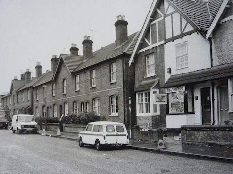
The photo (see below) is of a Guildford street, close to the town. I think is dates from the 1980s. By this time the ‘corner shop’ had become an small video shop. Even they are becoming scarcer these days! Any ideas where it is?
If you think you know the answers, leave a reply in the box below. All replies will be posted at the same time in about a week’s time, along with a new post with the answers to this week’s photo and mystery date, and the next pair of images.


David Smith
May 5, 2012 at 10:36 am
Hmm
Is this Walnut Tree Close?
Shame most of the surrounding cottages inc corner shop have been bulldozed! (if this is the location!)
Ian Plowman
May 5, 2012 at 1:34 pm
The photo is of Walnut Tree Close
The date 16th September 1968 is the floods and the plaque is on the doorway to St Nicholas Church on the corner of Bury Street marking the high water level
Regards
Ian
Dave Peters
May 6, 2012 at 11:43 pm
No 1 On St Nicolas Church – commemorates where floods got to!
No 2 Around Haydon Place/Leapale Lane
Susan Donald
May 7, 2012 at 10:21 pm
The photo is of Walnut Tree Close, where Cyrenian House now stands. We lived in the house next door but two to the left of the video shop in the picture. The houses were demolished in 1988 on both sides of the road to make way for flats.
brian holt
May 10, 2012 at 7:20 pm
The second picture is off the video shop in Walnut Tree Close, which was next to the railway houses, that are also in the picture
Darrol Radley
May 12, 2012 at 5:45 pm
The plaque is on the wall of St. Nicolas Church at the bottom of the High Street opposite the George Abbot pub. It denotes the level of the flood waters on that day. This was the worst flood of recent times and effectively cut Guildford town centre in two. It flooded the crypt, Loseley Chapel and even part of the nave.
The road shown is Walnut tree Close looking towards the station and town centre. Only one of the two blocks of terrace houses remains, the block in the foreground and houses with the shop have all gone to be replaced by flats.