- Stay Connected

Socialize

 Abraham Lincoln
If given the truth, the people can be depended upon to meet any national crisis...
Abraham Lincoln
If given the truth, the people can be depended upon to meet any national crisis...

 Guildford news...
for Guildford people, brought to you by Guildford reporters - Guildford's own news service
Guildford news...
for Guildford people, brought to you by Guildford reporters - Guildford's own news service
Around The Very Top: Castles, Gin and Two North East Tips
Published on: 6 Jun, 2015
Updated on: 12 Jul, 2017
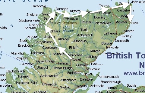
Around The Very Top of Scotland
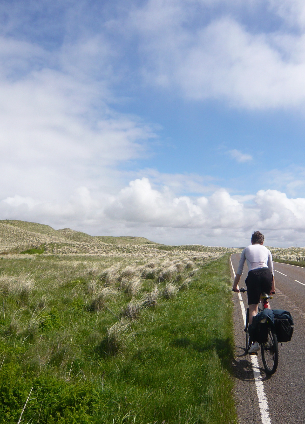
Martin Giles is cycling around the top of northern Scotland with his son Tom. This is a report on the leg from Thurso to John O’Groats. Find other reports in the series by searching on: “Around The Very Top”.
Note: most images can be enlarged by clicking on them.
By Martin Giles
The man at our hotel in Thurso was not a cyclist, he was not even a Scot.
He was from Hampshire – Winchester in fact – but like many others he felt it his duty to warn us about the route ahead. “There are a couple of hills.” he said, giving me a serious, “Do you really know what you’re doing,” look over his glasses.
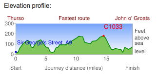
The cross section of our route to John O’Groats – the hills, such as they were, did not even reach 200 feet.
I thought we had better get going before he called us a taxi.
As we crossed the bridge over the River Thurso Tom spotted a ruined castle on the east bank of the river. He wanted to explore so we cycled down towards it until we were by a gateway with a lodge and a minibus containing a crew, perhaps domestic staff, just emerging from the gate.

The ruined castle of Thurso. In the background is Scrabster the port a few miles from Thurso and Britain’s second biggest white fish port as well as a ferry point for the Orkneys.
“Can we get down to the castle through here”, I asked. Vigorous shaking of heads. “Is there another way round?” There was a quick conflab between driver and passengers followed by more shaking of heads.
So you can see dear reader that we tried to explore and report more about Thurso Castle but it has either become an MI5 base or the headquarters of one of those international criminal organisations James Bond likes to smash. Either way it was in an ideal location – let’s face it how many curious visitors get as far as Thurso?
Passing what appeared to be a social housing estate, in the utilitarian, soviet style of architecture with, lest it should retain any attractiveness, a finish of grey painted pebble dash that, for some unknowable reason, has found favour north of the border, we turned east onto one of the straight sections of roads for which, this far north, we cannot blame the Romans.
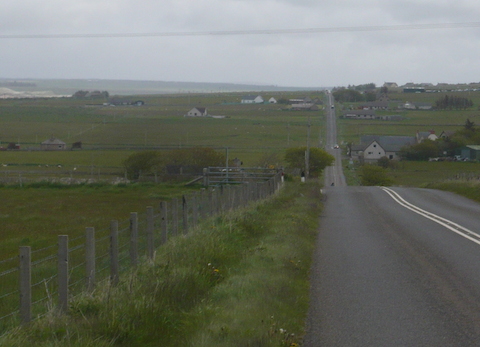
The straight road to Castletown.
It went slightly downhill then a little uphill but progress was easy. On the slightly downhill section I was doing 27mph as I entered a 30mph limit. I wondered if any cyclists ever get booked for speeding?
The speed made me so warm with excitement that for the first time on the trip I stopped and stripped off to shirt sleeve order. Thank goodness for my new Bettyhill bungees to secure my jacket.
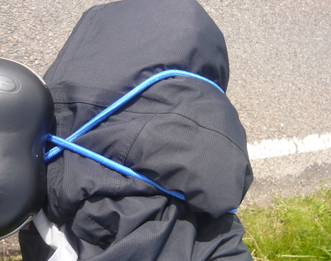
At last it was warm enough to stow my jacket.
We passed through the linear settlement of Castletown on another straight stretch. The only thing that I really noticed was an attractively designed drill hall, now used as a community hall it seems, judging by the activities listed on a website entry: Air Weapons, Brownies, Badminton, Dancing, Bingo, Sales and Dances. “Air Weapons” stands out a bit. Can Brownies earn an air defence badge?

Castletown Drill Hall.
As I cycled past I wondered who had paid for such a good quality building and how such a small settlement could support a territorial army unit in times gone by, presuming that was its original purpose.
A left turn and we were in a little wood with bluebells still happily flowering in June. No wonder – their thermostats could easily be fooled into thinking it was still April.
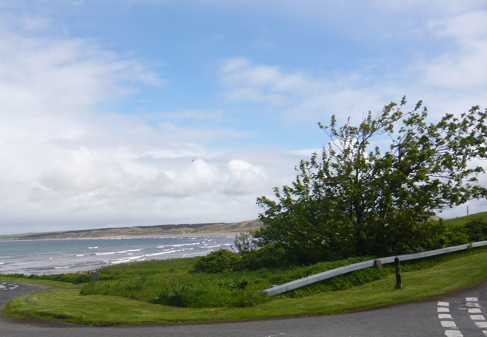
The long sandy beach of Dunnet Bay.
At the end of the wood we emerged at the coast to a glorious white beach stretching out before us. On the other side of the road a derelict mill, ripe for conversion into a guesthouse, I would have thought, given the views. In poor weather, visitors could always nip around the corner for a game of Bingo or get the Brownie troop to give them a talk on surface to air missiles.

This derelict mill might make a good guest house. It would have some stunning views over the bay.
A few hundred yards on and we were among dunes covered with grass bleached almost white. It had a very unusual and attractive effect.
The bleach grass gave a surreal effect to sand dunes that I have not completely been able to capture in this photo.
Also to our left now was Dunnet Head the tip of which is the northern most point of Great Britain. On the road is the village of Dunnet. There was a sign saying, “Gin Distillery,” which seemed an oddity in the Highlands.
Although a Scot, my wife Fiona dislikes Scotch whiskey but is partial to a gin and tonic, a pleasure we share. Tom has developed this penchant by introducing us to the variety of gins now on offer. It seems that the gin industry has taken a leaf from their whiskey distilling colleagues and realised that variety can be profitable.
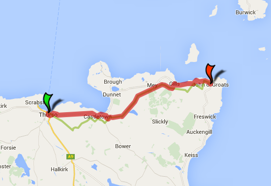
Thurso to John O’Groats – 20 miles. In fact we kept to the coast road so that we could visit the Castle of Mey.
I asked Tom if he would like to stop for a look around, he said he would but we were disappointed when a young woman tending a planted bed in front of the small building said they were closed. I wondered if it was a one woman show and that she could not garden and show us around at the same time.
It was the distillery for one of Scotland’s most recent gin additions, I think, the award winning “Rock Rose”. Their glossy website shows that they have named their still “Elizabeth”, a nice touch, perhaps influenced by the late, royal owner of our next port of call, The Castle of Mey.
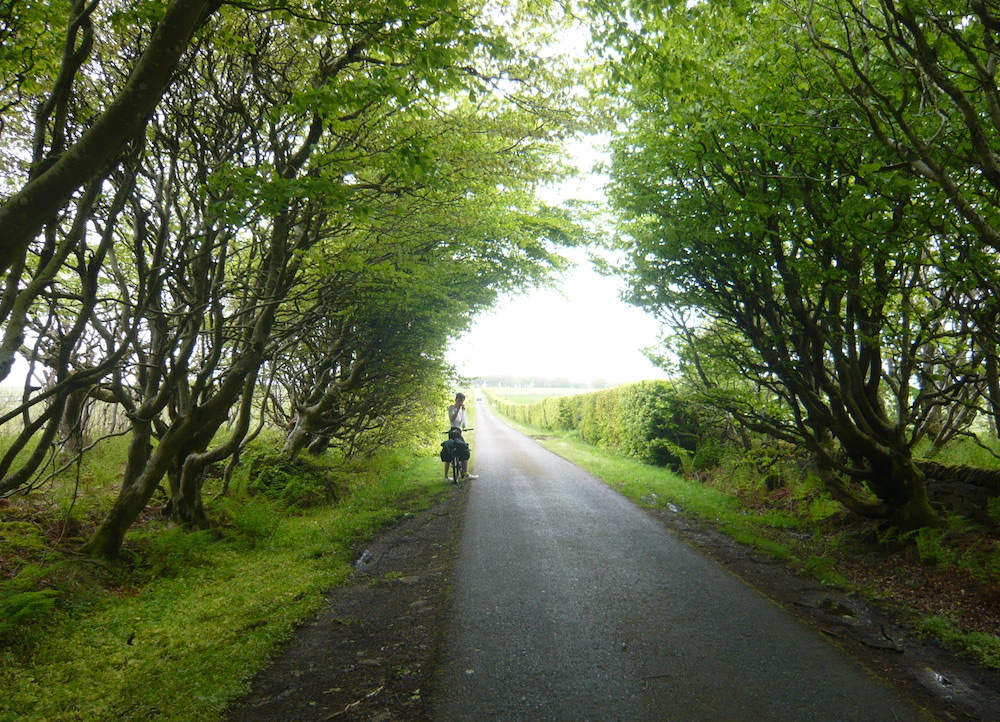
The natural tree tunnel makes an attractive entrance to The Castle of Mey.
The entrance to the castle from the main road is formed by an attractive natural tunnel of trees. We cycled down the drive eagerly. We were both hungry by now and we planned to have our lunch in the castle tea-shop.
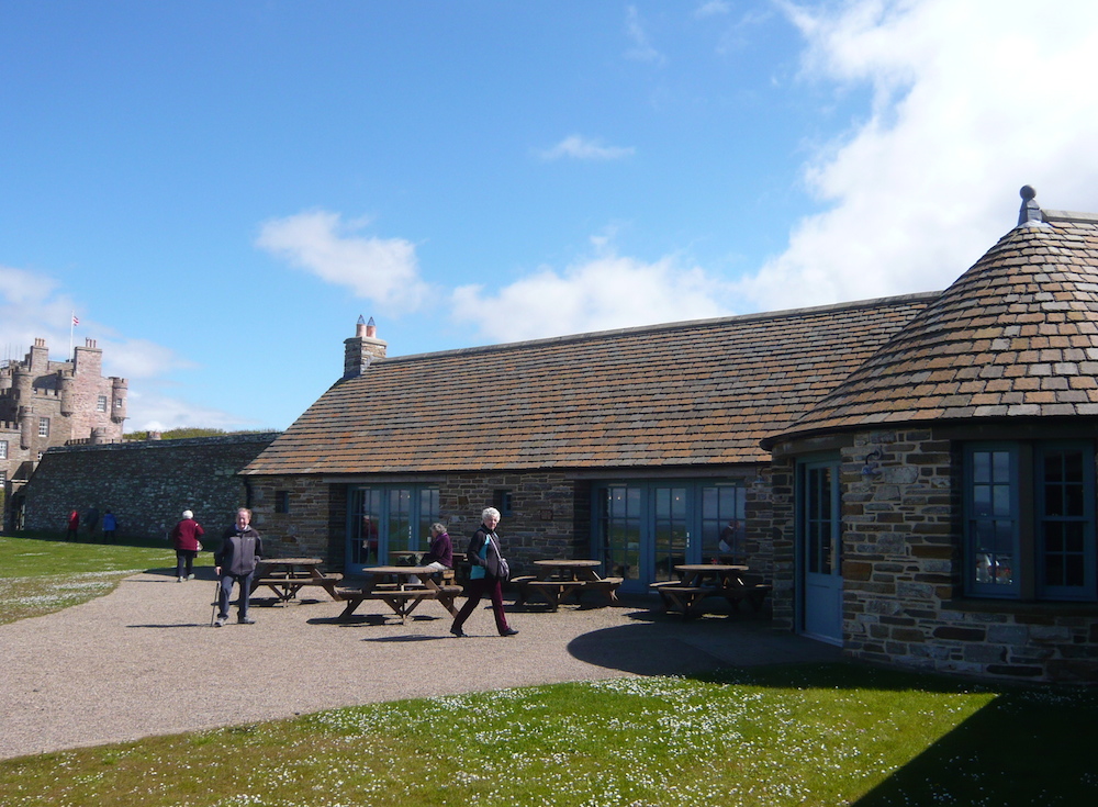
The tea-room and gift shop at The Castle of Mey carefully designed to blend in.
The tea shop which was opened fairly recently by Prince Charles, or the Duke of Rothesay as he is known in these parts (it’s the Scottish title for the heir apparent) has been well designed to blend in with its ancient surroundings. As well as looking good they serve a good lunch: I can recommend the beef sandwiches.
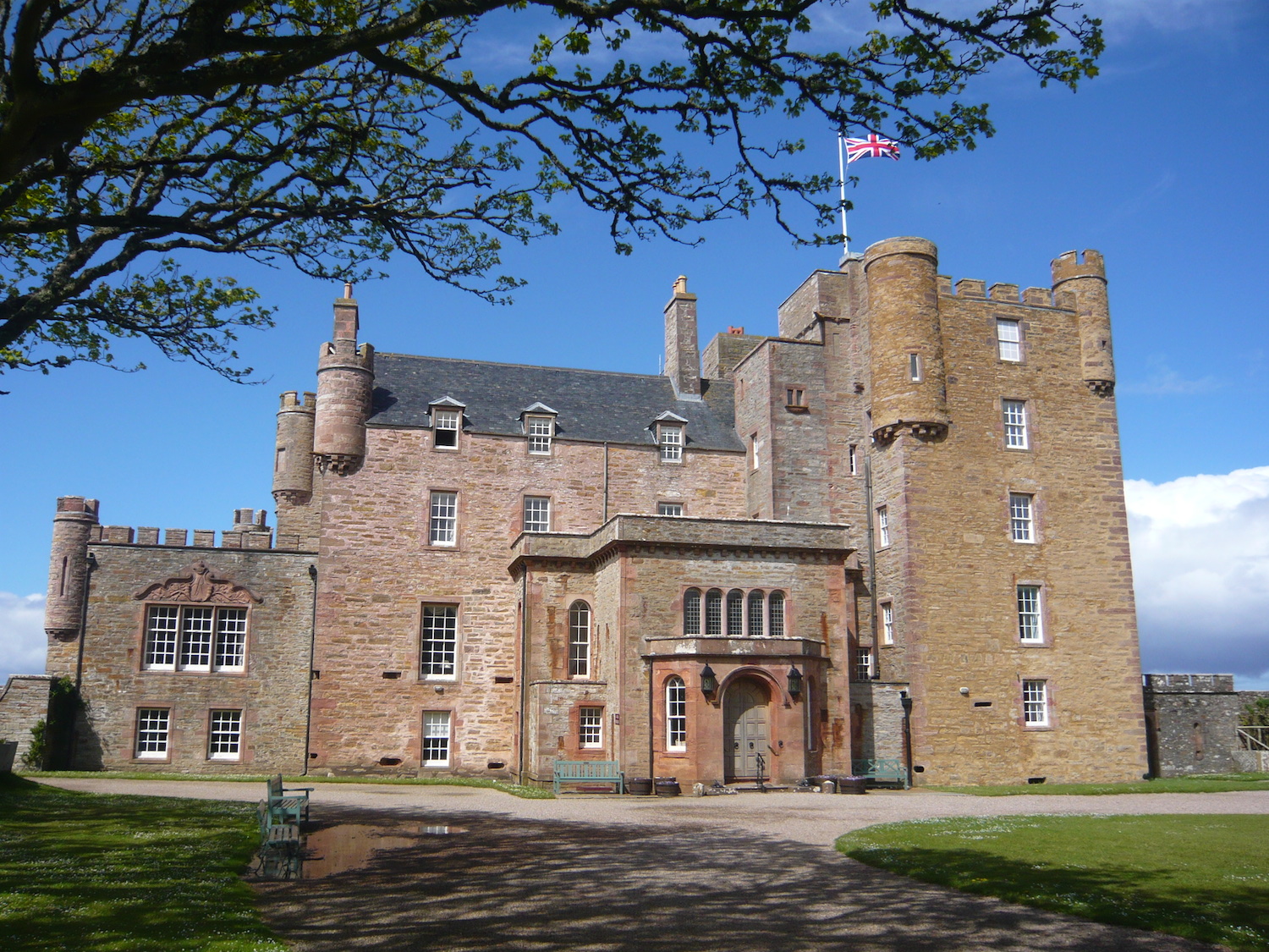
The Castle of Mey, with a rare, at these latitudes, Union Flag and some blue skies, at last.
After lunch we had a tour of the castle. I had not realised that the Queen Mother had only purchased the place after her husband George VI had died. She had seen it whilst visiting some friends close by to find some peace and quiet after her sad loss. Caithness is certainly a good place to get away from it all.
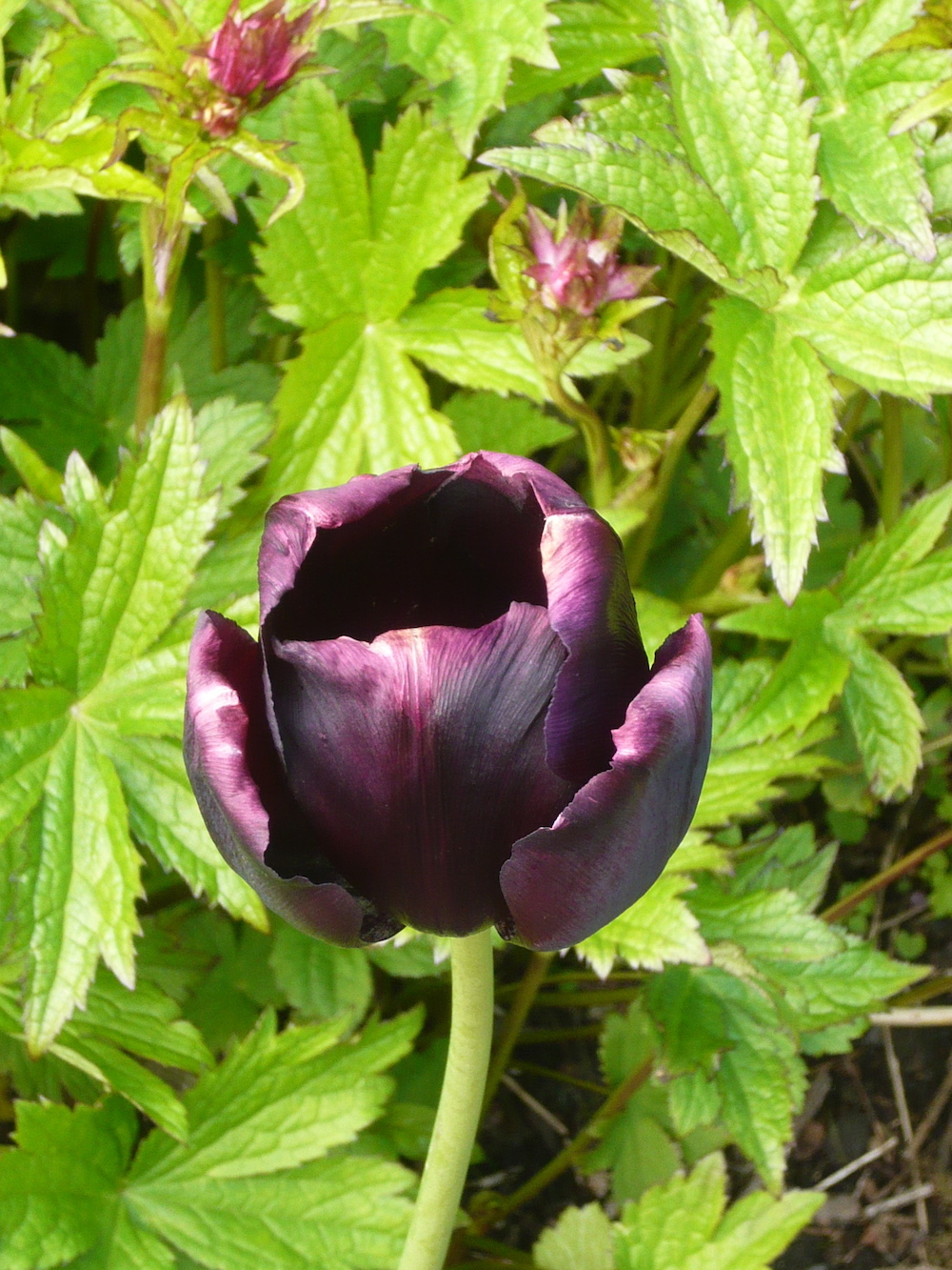
A black tulip in the castle’s walled garden.
Always on the search for a bargain, according to our Icelandic guide, she had snapped up the property for just £100 (in 1952), but it was in a pretty poor shape and required considerable investment to make it comfortable. The Queen Mother did a good job. It is a small castle, some of the rooms looked as if they could be cosy, and its scale meant that one could actually imagine living there.
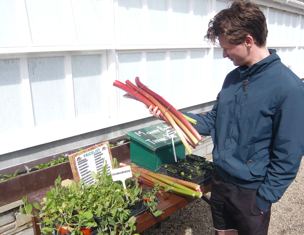
Also from the walled garden some fine rhubarb, £1 a bunch.
Just before we left I spotted Rock Rose Gin miniatures on sale in the gift shop so was able to bring a wee taste back for the wee wifie.
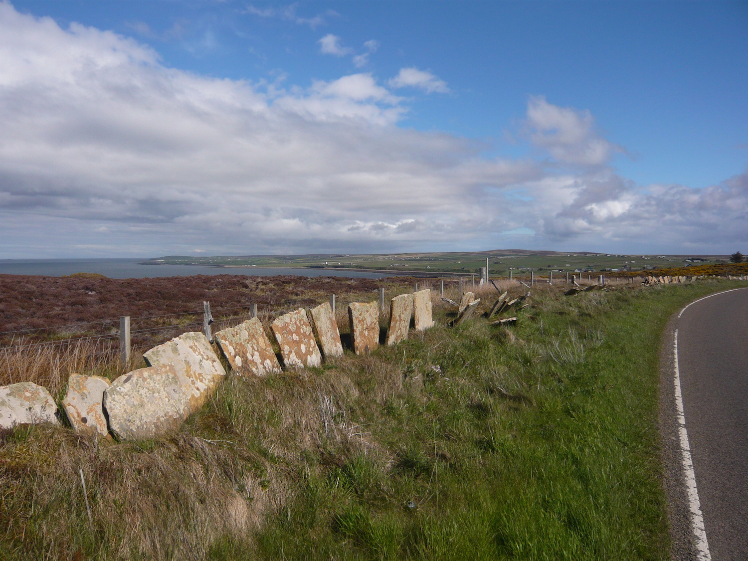
Only another six miles to John O’Groats, the fields still in some places with flagstone borders, typical of Caithness where suitable stone is a plentiful resource.
From Mey it was only another six miles to John O’Groats. There was a bit of wind but it did not trouble us. The landscape was fairly flat so we were soon at the settlement famous for being the end point of epic walks and bike rides.
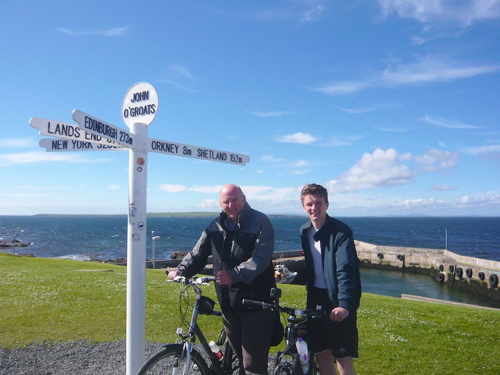
We cycled down a hill past some strange looking timber chalets to the “centre” where there was the Victorian hotel, a Tourist Information Centre (TIC), two coffee/gift shops a car park, the harbour and ferry point (for foot passengers to the Orkney Islands) and, of course, the famous sign post.
Discovering, at the TIC, that our guesthouse was a mile beyond, we decided to have a cup of coffee and then ask a passing tourist to take our picture under the sign. They, of course presumed we had just cycled up from Land’s End so we had to explain that no, we were just frauds that had come 150 miles on a semi circular trip from Lairg. They were kind enough to still appear impressed.
We had not completed the long journey from Lands End but it had still been, for us, a memorable bike ride.
All that was left now was for the gradual climb up to the guest house. It was a white flat roofed one-storey building and I wondered whether it was a converted Coastguard Station, sited a little inland to confuse people but actually it was a former shop.
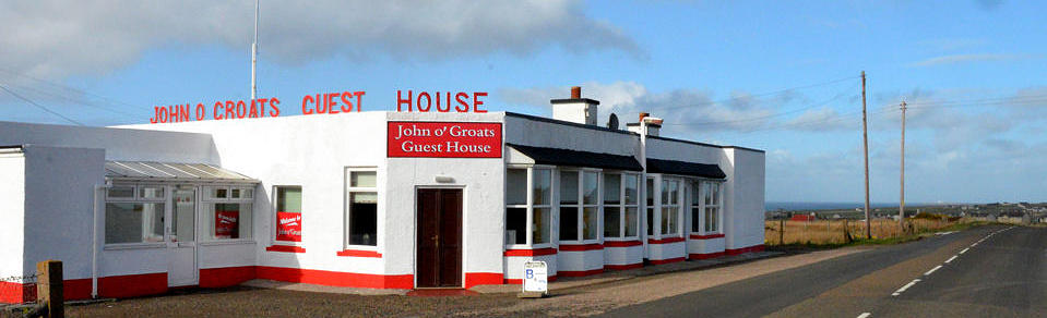
Not a former Coastguard Station, in fact a former shop – now a guesthouse to be recommended where hospitality is an art form. Photo courtesy Joh O’Groats Guesthouse.
Our host saw our arrival and quickly emerged to welcome us and whisk our bikes away to their shelter. Inside we met our hostess Mary and were shown a family room, well decorated, very clean with everything we required.
Mary and Mark proved to be the most attentive hosts you could wish for. They frequently asked if there was anything else we wanted to eat or drink or any other guidance or advice they could give.
I did cruelly consider inventing some outlandish request to test and tease them, “Could we have fruit scones made with Welsh flour and organic golden raisins from Italy?” If I had asked, I am sure Mark would have said, “Of course, I will just fly down to Tuscany and come back via Cardiff. Mary will get you a coffee while you wait.”
Instead we asked more reasonably about Duncansby Head and were given expert advice on how best to get there by bikes and then proceed on foot to see the bird colonies on the cliffs (Mark is a bird watcher – John O’Groats is a good place for twitchers) and the conical Duncansby sea stacks.
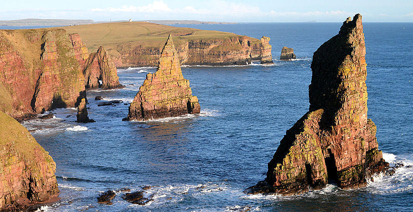
Duncansby Stacks – photo courtesy John O’Groats Guesthouse.
The point of the headland is marked by Duncansby Head Lighthouse, built in 1924 by David Alan Stevenson, another member of the Stevenson family famous for building lighthouses and producing Robert Louis Stevenson, author of Treasure Island, Kidnapped etc.
A minor public road leads from John o’ Groats to Duncansby Head, which actually makes Duncansby Head the farthest point by road from Land’s End. Perhaps they should scrap all the records set to date and move the signpost?
The light was failing a bit by the time we got to view the stacks but it was still worth the effort. Having been to the northwest tip of Scotland and Great Britain we wanted to go to northeast tip too.
It strikes me that another northeast tip, if you have a hankering or a need to stay in John O’Groats, is to recommend a stay at the John O’Groats Guesthouse. We returned to it tired but satisfied. Sadly, tomorrow would be the last day of the tour.
Next: the last leg to Wick.
Share This Post


Responses to Around The Very Top: Castles, Gin and Two North East Tips
Leave a Comment Please see our comments policy. All comments are moderated and may take time to appear. Full names, or at least initial and surname, must be given.

I'm living well for nothing at all! (See: No Trifling Matter: Magpie Trapped in Godalming Sainsbury’s)


Next stop, Debt Chasm! (See: We Should All Be Outraged About the Failure to Deal with Legacy Debt)


Sharkey Ward
June 15, 2015 at 1:36 pm
The gentleman writing this piece may think the slightly derisory tone is humorous however decisions made in this part of the world about how and what with the local houses are built hardly seem a relevant source.
The ‘darling’ used on the housing developments is a traditional way of finish over a water resistant cement layer. The north does not have a history of massive industrial development from which highly wasteful ‘redbrick’, expensive houses may be constructed.
History does not end today and a little more research on his part may make his comments on this and other subjects a little more worthy and enjoyable.
The Thurso castle has normal everyday reasons for access restrictions as many other privately owned premises ‘downside’.
The Gin establishment employs a very lovely lady to look after their surrounding gardens and provide visitors (a warm welcome if informed previously).
I cannot comment on the rest of the article as the tone of that I had read just made me feel quite ashamed to be English.
Opinion without knowledge is as bad as trying to be humorous using condescension.
Both fail.
Eddie Ward
December 11, 2016 at 5:58 pm
Just been reading the account of Martin and Tom Giles’ journey from Thurso to John o’Groats.
I did a similar cycle ride from Thurso to Dunnett Head in 2010. My trip took me to Castlehill and its harbour.
The harbour was built in 1820 to transport the flagstones quarried nearby.
Within a short space of time, the flags were sought after throughout Britain, and indeed were exported world wide. By 1900, over 500 men were working in the local quarries.
In 1902, their best year, they shipped over 35,000 tonnes of flags. When you consider how small the harbour is, that is no mean feat.
By 1920, times were changing, and the quarries were closing down, and so too, the harbour. It is still worth a visit if you are in the area, and it is hard to visualise the number of people who used to live and work nearby.
Credit to Undiscovered Scotland for the facts in this wee note.