- Stay Connected

Socialize

 Abraham Lincoln
If given the truth, the people can be depended upon to meet any national crisis...
Abraham Lincoln
If given the truth, the people can be depended upon to meet any national crisis...

 Guildford news...
for Guildford people, brought to you by Guildford reporters - Guildford's own news service
Guildford news...
for Guildford people, brought to you by Guildford reporters - Guildford's own news service
Masterplan For Town Revealed – Riverside Sites To Be Transformed
Published on: 28 Aug, 2015
Updated on: 8 Sep, 2015
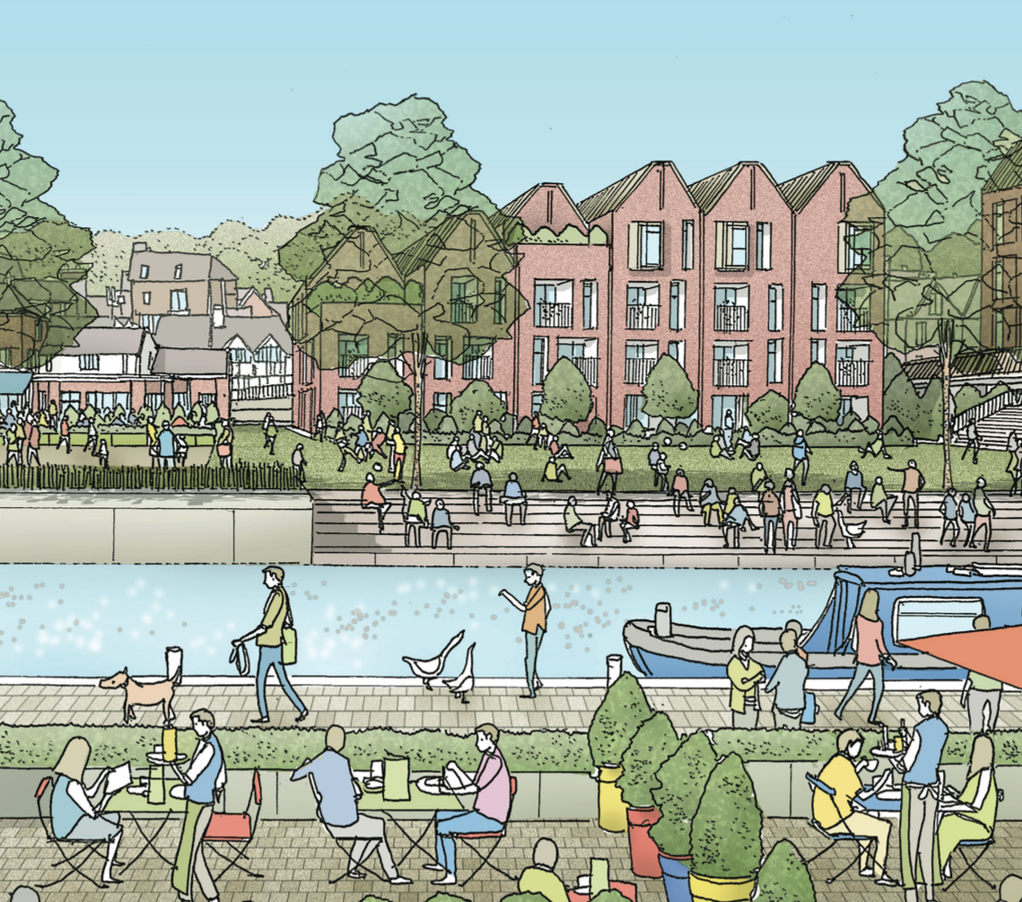
Artists impression of how the view across to the Farnham Road Car Park at the back of the George Abbot pub could be transformed. Opening up the riverside is one of the main themes of the draft masterplan.
Guildford Borough Council (GBC) has today (August 28) published a draft Guildford Town Centre Masterplan prepared by Allies and Morrison who have been working on the plan for over a year.
Six weeks of detailed public consultation will start in October.
The blueprint to reconnect Guildford’s town centre with its historic, but formerly largely industrial, riverside is intended to transform underused areas and create high-quality, attractive new homes, as well as more retail, leisure, hotel and office space.
The masterplan is based on five key themes: “From concrete collar to major tree-lined park and boulevard [opening up the riverside]; a healthy approach to movement [tackling traffic problems]; the new riverside community park; growing a successful town centre; and planning for sustainable development.”
A council press release states: “The plan responds to local people’s feedback and ideas from the initial vision consultation in July 2014. It would protect the heritage and character of the town’s core and bring much needed transport and flood management improvements.”
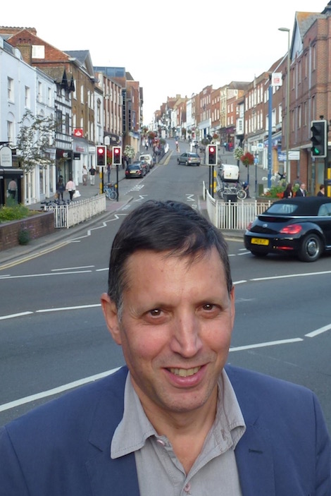
Antony Rifkin, partner at Allies and Morrison who led the team which prepared the draft masterplan.
Prepared by a team led by Antony Rifkin of Allies and Morrison, an urban planning and architecture practice, it is claimed that the draft masterplan answers calls from local residents and businesses to create a larger and more vibrant town centre.
Once amended to reflect outcomes from public consultation and viability testing, important deliverable elements of the masterplan will become a key part of the wider, 20-year Local Plan for the whole borough. It will also influence plans for the redevelopment of North Street.
The press release continued: “Action to address the town’s traffic problems and creating ‘streets for people’ are two core themes of the draft masterplan. A waterfront community park would open up public access to the river. And improved, safe pedestrian and cycle routes would connect the town centre’s existing facilities to the new residential, shopping, entertainment and business developments.
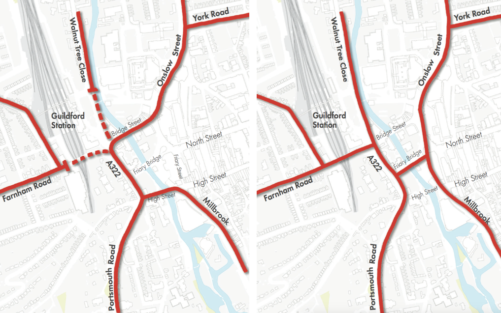
Two preferred options to “turn-off” the gyratory. Option 1 on the left pedestrianises Bridge Street but maintains two river crossings, one by reopening the Town Bridge to traffic. On the right, option 2 has only one river crossing but minimises the effect of traffic on the river frontages.
“There are also proposals to enhance crossings over the railway and river, improve traffic flows, offer better parking and promote sustainable transport. Under a separate plan, Guildford railway station would become one of a series of central hubs to connect all modes of travel to, from and within the town.”
“The planned changes would safeguard views to the surrounding landscape by maintaining ‘visual corridors’ to preserve the links between town and country, which are such an important feature of Guildford’s special atmosphere.”
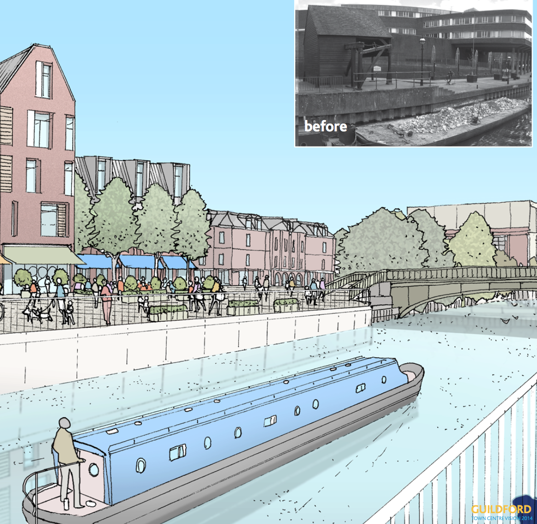
An artists impression of how the riverside area of the of the old town wharf could be developed.
According to the press release residents will be able to: “keep in touch with the latest updates by following news on the council’s website and social media, up to and throughout the public consultation period”.
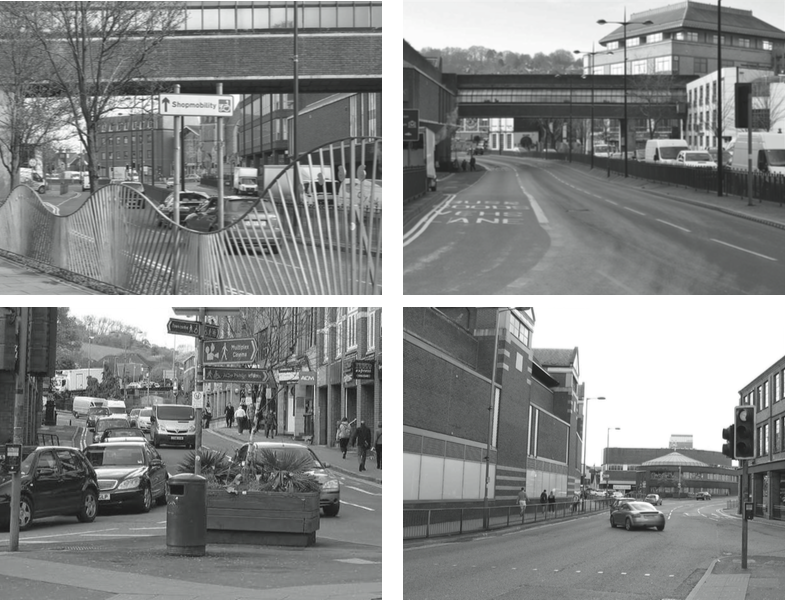
Some examples pictured in the Allies & Morrison report of poor quality urban environment in Guildford.
The need for a masterplan for Guildford was only reluctantly accepted by the council following a campaign by the Guildford Vision Group whose legal challenge against a former draft Local Plan triggered the downfall of the previous council leader Tony Rooth (Con, Pilgrims).
After a initial stand-off period, the council under the leadership of Stephen Mansbridge, developed a friendlier consultative relationship with the group. In April this year the GVG published its own masterplan. Unsurprisingly, there is considerable overlap especially regarding riverside redevelopment and tackling the constraint of the gyratory.
Councillor Paul Spooner (Con, Ash South and Tongham), lead councillor for planning, said: “The draft Town Centre Masterplan puts forward a radical vision for Guildford’s future, based on local people’s clearly-expressed wishes.
“Our borough’s success has been built on the far-sighted and brave decisions of past generations. Now is the time for us all to show the same conviction, by thinking big and investing in the town’s future.
“This is still very much a work in progress, so we look forward to hearing people’s views on the proposals. Feedback and suggestions from the public will help us to create a plan that can support Guildford’s growth, prosperity and quality of life for the rest of this century.”
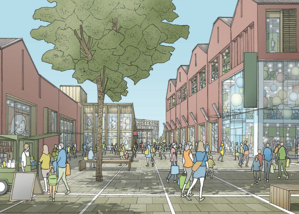
Artist’s impression of mixed use proposals for North Street.
Councillor Stephen Mansbridge (Con, Ash South and Tongham), leader of the council, said: “We want Guildford to be a better place to live, work and visit. The draft masterplan proposes some exciting designs to regenerate the town centre and secure a vibrant future. We’re committed to delivering what the town and borough need for the benefit of local people.”
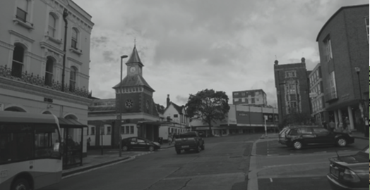
Current view of the top of North Street.
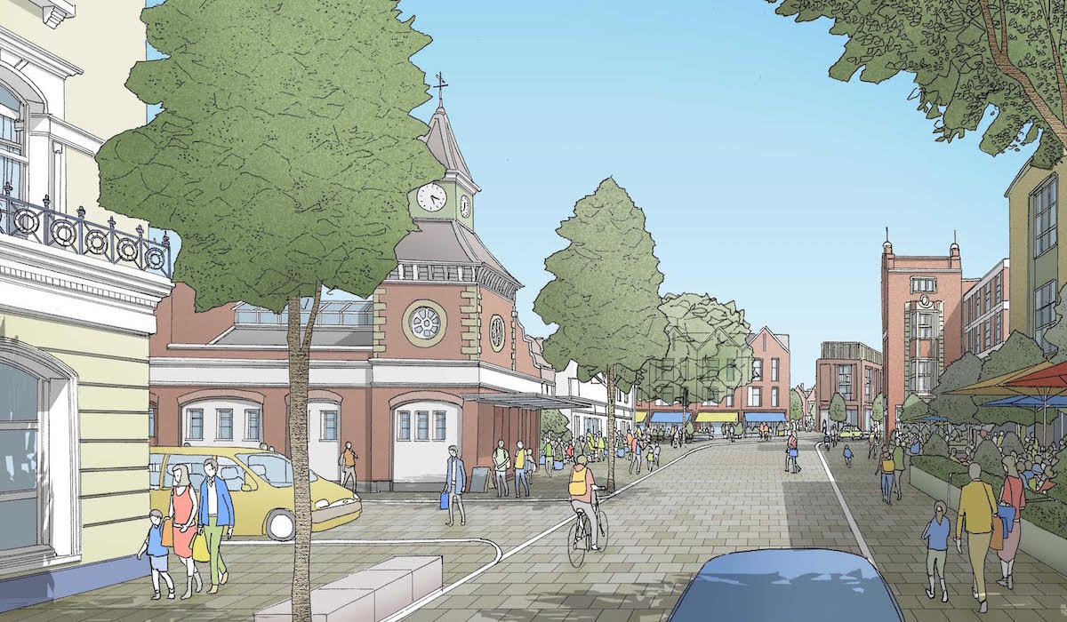
How it could be changed if the 1960s block currently accommodating TGI Friday and 96.4 Eagle Radio was removed and replaced with a more congruous building.
Leader of the opposition at Guildford Borough Council, Cllr Caroline Reeves (Lib Dem, Friary & St Nicolas) said: “I am very pleased that this is now moving forward, we need to have a clear direction for the town so that we can stamp the identity we want on future development.
“The importance of our heritage and the countryside around us has been acknowledged, as well as the need to enhance the river and improve life for pedestrians and cyclists.
“Improvements to our traffic management are key to the future success for the town and we need to ensure that when the final Town Centre Masterplan is agreed, we hold our nerve and create a town for future generations to enjoy, and where business can continue to flourish.
“I look forward to talking with residents during the course of the consultation, we need everyone to really engage with this important document for the future of our town.”
The council’s customer and community scrutiny committee will consider the masterplan on September 8 2015, before the GBC Executive reviews and approves the final draft for consultation on September 29.
More articles on different aspects of the draft masterplan and reactions to it will be published in due course. Please check back.
Share This Post


Responses to Masterplan For Town Revealed – Riverside Sites To Be Transformed
Leave a Comment Please see our comments policy. All comments are moderated and may take time to appear. Full names, or at least initial and surname, must be given.

I'm living well for nothing at all! (See: No Trifling Matter: Magpie Trapped in Godalming Sainsbury’s)


Next stop, Debt Chasm! (See: We Should All Be Outraged About the Failure to Deal with Legacy Debt)


Jim Allen
August 29, 2015 at 9:25 am
Interesting on first read through but no mention whatsoever of ensuring that buses meet the trains – surely a fundamental and essential function of the railway station to ensure rush hour traffic is reduced.
Dave Middleton
August 29, 2015 at 2:14 pm
Interesting how the pictures, presumably provided by Allies & Morrison, show the existing streetscapes in drab and dreary black and white, whereas their illustrations of the future are all in nice colours.
As for opening up the currently pedestrianized Town Bridge to traffic, I’d be very surprised if the existing bridge structure could support 40 Tonne trucks, or even the sheer volume of traffic that currently passes along the A281 Millbrook.
Yes the images are taken from the Allies & Morrison report. The Town Bridge, is reported to be capable of bearing motor vehicles however the report does say, that for the preferred option that utilises the Town Bridge crossing (one of two options), it would probably have to be strengthened or replaced. Ed
Bernard Parke
August 29, 2015 at 2:44 pm
The Town Bridge was rebuilt when I served as vice chairman of the building and works committee.
I was told by the engineers at the time that the bridge had been rebuilt to stand the weight of very heavy traffic.
It was the Farnham Road Bridge (A31) which caused concern in the eighties when parts fell onto the rail track.
No doubt this is regularly inspected as it carries far heavier loads these days with all the weighty through traffic.
Bibhas Neogi
August 30, 2015 at 8:00 pm
The Town Bridge was assessed by Surrey County Council under the UK-wide Assessment and Strengthening programme coordinated by the Department for Transport for all road bridges.
Those found deficient were either strengthened or weight restricted as long as at least one other viable route for “normal” traffic (generally referred to as 40T lorries) could be found.
Town Bridge was strengthened but I suspect not up to the full 40T loading. If the bridge is to be further strengthened and brought back to use, it could be widened at the same time to cater for at least three lanes of traffic and cycle lanes plus wider footways.
If it is widened, I would like to see its elevation of decorative edge girders reinstated.
Bibhas Neogi
August 29, 2015 at 3:37 pm
One can only hope that the traffic flow could be maintained at an acceptable level for the two proposed scenarios. Without the traffic data it would not be fair to dismiss these options. However, my guess is that no serious thought has been given yet if one considers the following issues,-
1. In Option 1, Bridge Street is pedestrianized and yet a two-way flow has to be maintained at the same time. Not much of an improvement if a cycle lane has to be accommodated as well! The Town Bridge would most probably need strengthening and possibly a bridge alongside for pedestrians and cyclists would also be required for safety reasons. Access from Walnut Tree Close and Farnham Road to Park Street/Bridge Street appear to be have been barred. So what is the route for traffic to and from Park Street for these two directions?
2. In Option 2, it is not clear how this minimises the effect of traffic on the river frontages unless the route is relocated on Friary Street. The sketch is still showing Friary Street intact though.
3. In Option 2, it is difficult to see how the Friary Bridge, the one and only bridge, would cope with the volume of traffic and all bus routes accessing the railway station as the transport hub.
4. No illustration has been shown for the proposals to enhance crossings over the railway and river.
These colour artwork would become collector’s items as there is really very slim likelihood, I think, of these coming to fruition unless a big dose of reality is injected with traffic engineering that would genuinely make Guildford town pedestrian friendly. Anything else is simply pie in the sky.
Caroline Sawers
August 31, 2015 at 11:57 am
The current view of the top of North Street shows four charming and individual buildings, Cloth Hall, old fire station (now public loos), old pub, and Guildford Institute. The new one only shows the Cloth Hall. Are all interesting buildings to be demolished in the pursuit of progress?
The images contained in the report and copied in this article are artists impressions and should not, we understand, be taken to be an accurate forecast of which buildings are to be demolished or what new buildings may be built or indeed how they will appear. All will be subject to planning applications and most, if not all, the buildings you mention are listed. Ed
Bibhas Neogi
August 31, 2015 at 10:41 pm
The listed buildings are: 12 North Street on the right hand corner going from North Street to Haydon Place, the Old Fire Station, Quaker House and the Old Pub.
Guildford Institute which is No. 10 North Street is not a listed building although I think it has a lot of character and should be preserved.
In Chertsey Street, Nos 5-7 on the left hand side after Dolphin House and on the right Nos 20,22,24,26,28 &30 are listed buildings currently obscured by Dolphin House, so not visible from North street.
Trish Noakes
September 3, 2015 at 1:57 pm
The Guildford Institute DOES have a listed status – specifically the facade – but our address is in Ward Street NOT North Street as this is where our doorway access is and always has been I am told.
Trish Noakes
Institute Manager
Bibhas Neogi
September 3, 2015 at 9:33 pm
There appears to be some inconsistency on the national website for listed buildings in this location. No.10 North Street is not listed but Guildford Institute building is. However, these two buildings appear to be one building on the outside sharing the same architectural details.
Guildford B C lists both buildings as listed but lists No.12 North Street as locally listed whereas the national website lists this a listed Building! It may well be that No. 10 North Street, the Bank, is a locally listed building. I’m sure GBC would be able to clarify.
The map included in the Masterplan Report Seems to show the Guildford Institute building as listed. Ed
Basil Minor
August 31, 2015 at 12:15 pm
I agree with Bibhas Neogi. If Farnham Road (A31) and Park Street are closed off at the railway bridge, how does one get to the west of Guildford? The only other route is via the A3 at the Dennis roundabout which is already a bottle neck and would add considerably to vehicle emissions for the extra distance travelled.
The west of Guildford contains the university, hospital, research park, existing housing, perhaps another 3,000 houses on university land and all routes towards Winchester.
This is a stupid proposal unless a new road from Madrid Road across the railway and river passing between the law courts and the Bedford Road car park joining Onslow Street in a mega junction near St Saviours Church were constructed.