- Stay Connected

Socialize

 Abraham Lincoln
If given the truth, the people can be depended upon to meet any national crisis...
Abraham Lincoln
If given the truth, the people can be depended upon to meet any national crisis...

 Guildford news...
for Guildford people, brought to you by Guildford reporters - Guildford's own news service
Guildford news...
for Guildford people, brought to you by Guildford reporters - Guildford's own news service
Uphill All The Way – Over The Himalayas – (Mkt Harboro’ to Melton Mowbray)
Published on: 31 May, 2014
Updated on: 2 Jun, 2014
 This is the sixth report on the author’s progress in his bid to cycle from Guildford to Edinburgh. The reports follow: Uphill All The Way – The Idea and Uphill All The Way – The Plan (Part One) and Uphill All The Way – The Plan (Part Two)
All Uphill All The Way articles can be found under the Leisure section heading on the front page, in their own sub-section called Uphill All The Way.
By Martin Giles
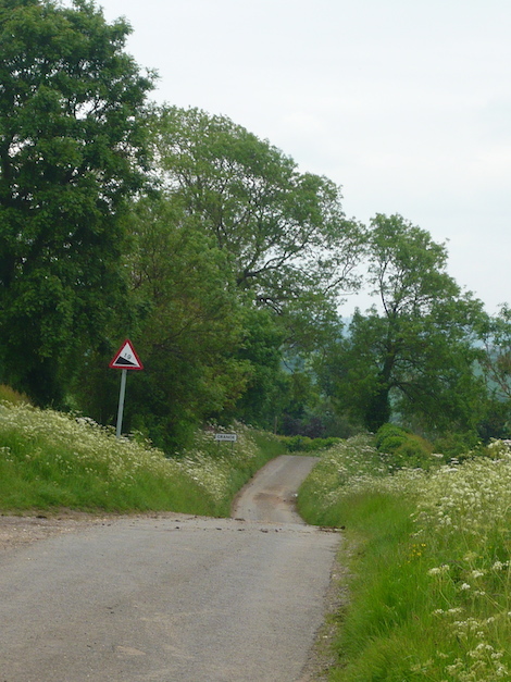
It is an axiom in the army that: “Time spent in reconnaissance is rarely wasted”. So is time spent studying the map.
Unfortunately I did not study the map hard enough before I set off confidently from the Angel at Market Harborough this morning. If I had, I would have known that, even though the distance to cover was only 24 miles I was in for some hard cycling.
I should have also noticed this:
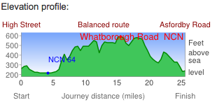
A fair representation of the today’s ride.
Each time I use CycleStreet to plot my route it produces a cross section of the route. They can be a bit daunting. On a previous occasion the cross section made it appear that I would be going over Mount Everest shortly followed by K2.
If I had bothered to look I would have seen that the cross section for the journey from Market Harborough to Melton Mowbray indicated that I would be crossing the entire Himilayan Range. It was quite accurate in this regard. At least that is how it felt by 3pm.
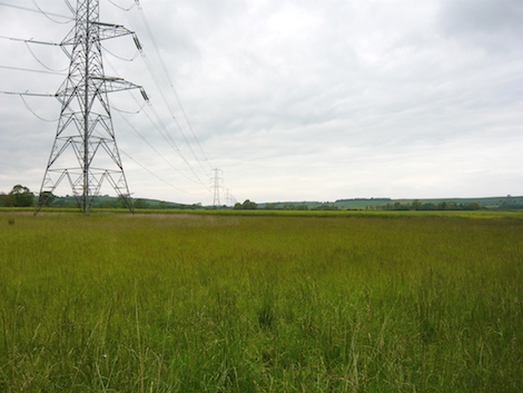
A row of ugly pylons – the only blot on the lanscape. What a pity the power lines are not buried.
It started well enough, despite a leaden sky. After I left Great Bowden there was a flat area. The forecast was for it to remain dry. Today was going to be a good day. A row of ugly pylons were the only blot on the landscape but I became aware that I was heading for a ridge.
The first few miles were flat but the first ridge was looming.
“I hope I don’t have to go up that.” I thought. But I did. Little did I know that it was the first of many that would gradually become more frequent and steeper.
At the top of the first hill of many. I started much further below around the corner.
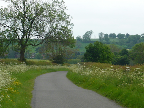
The consolation was the surrounding Leicestershire farmland, mainly arable but with some dairy cows, a number with cute calves, and sheep with frolicking lambs. It is a good time of year to enjoy such scenes.
Additionally there was the occasional building that caught my eye. a church and a farmhouse which I paused to photograph.
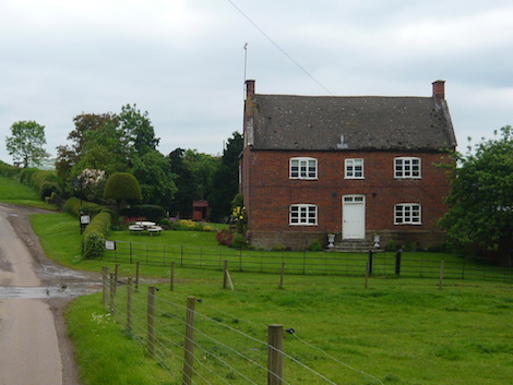
An attractive Leicestershire farmhouse.
At one point I was between a field of barley on one side and wheat on the other. Both looked in good condition, and why not plenty of rain but some sun too.
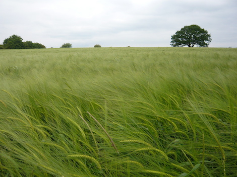
This field of barley was opposite a field of wheat.
I was going up hill and down dale regularly trying to carry as much speed from each descent into the next upward gradient. Sometimes though bends and blind corners meant brakes had to be applied. I saw my wife with her wagging finger instructing me to take no risks. She was right of course. Yesterday’s spill in the tunnel was warning enough.
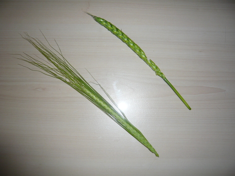
The barley left has the characteristic hairy appearance. Barley is often use for the production of malt, sprouted and dried barley seeds, used in brewing. The wheat ear on the right is threshed and milled to produce flour.
This went on until I noticed that I was approaching the 12 mile mark, i.e. half way. I thought I would stop at the next pub for lunch. It turned out to be in Tugby. I would have preferred a traditional inn. The Fox and Hounds was most definitely a gastro pub; the food was good – but it felt as if I was in a restaurant.
I continued on. Whether it was because I had already spent an hour or so descending hills with trepidation before toiling back up in low gear or weather the journey after Tugby got more challenging I am not sure. All I know is that I began to wonder if another ascent would force to start pushing something I was resisting fiercely perhaps foolishly.
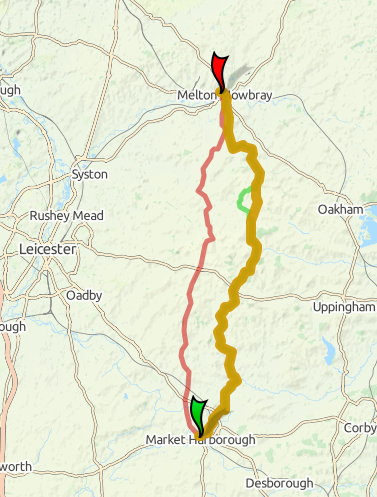
The brown line shows my route to Melton. The red line was an alternative ‘fastest’ route as plotted by Cycle Street.
Eventually there was a sign that said Melton 6 (in Mkt Harboro’ they said Harborough in Melton Mowbray they say Melton). I was relieved to see it. Once you get down to six miles or less the objective feels close.
I came to a T junction with an A road. It indicated Melton to the left but this was not right. I consulted my iPhone map and saw that I must have missed a turning a mile or so back. I was tempted to take the A Road but it was busy and also, I could see, steeply undulating.
So I retraced my steps which meant going back up the hill just descended, eventually found the junction I must have missed as I had been freewheeling down and took it. More up and down but Melton was not far. At one stage some wag had turned a cycle route sign 90 degrees so that it indicated the route went on to a rough dirt track that led steeply uphill.
“I wonder if any mugs have been fooled by that?” I thought and pressed on. I emerged at another T junction, this time with a B road. More perplexed map studying. I realised that I had been the mug. The cycle route sign had been right. I consoled myself saying that it was not a good route anyway. I would use the B road into Melton. Another steep hill immediately presented itself. What joy.
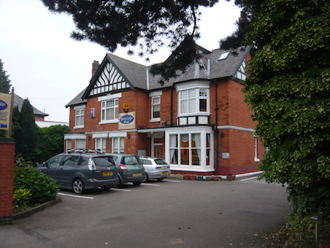
The Quorn Lodge hotel. Tonight’s accommodation.
There were further hills just before the town so that by the time I reached my accommodation, The Quorn Lodge, I was well and truly knackered. Today was supposed to have been easy following my 43 miles into Harborough.
Having secured my bike I retreated into my room and made the mistake of laying down before I had showered. I awoke an hour later still grubby but it was nothing that could not soon be fixed.
The Quorn Lodge is half a mile from the town centre which I still had not seen, so I decided to eat in town and take in the sights.
My first impression of the High Street was not favourable. It seemed deserted, a complete contrast to the pleasantly bustling Harborough that I had left that morning.
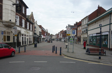
Melton did not give a good first impression. The place seemed deserted.
However, my first impression was false. It was soon dispelled by a chap sporting a high-vis jacket.
“What’s going on?” I asked.
“Oh I organise a classic car rally on the last Friday of every summer month,” he replied.
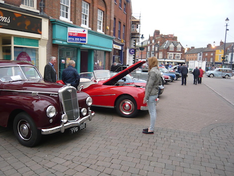
The classic car show was quite a community event. Perhaps we should do this in Guildford?
It was quite a show of cars, mainly from the 60s and 70s. They always bring back memories of course and it is interesting to see if they are quite as you remember. I had a long look at An Austin A30. These were tiny little cars but I was surprised at the leg room, considering.
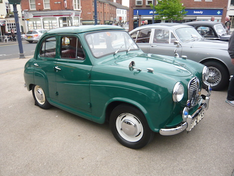
I had a long look at this A30.
The organiser also gave me invaluable advice on Melton’s eating options, indicating a street that contained most of the best.
He had mentioned Melton’s oldest building. It is a pub called the Anne of Cleeves, built of the lovely sandstone that I had first seen in Northampton. Evidently Thomas Cromwell owned it until he lost his head.
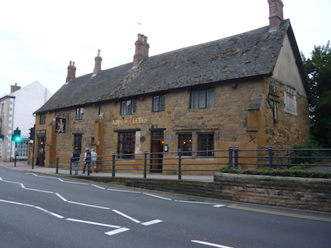
The Anne of Cleeves pub in Melton.
I went in. There was a lovely, lively and warm atmosphere. A smiling barmaid approached. “Can I see the menu please,” I asked. “have you booked? she replied.
I answered in the negative and she went off to see if hey could squeeze me in but came back within minutes to say that they couldn’t. What a shame. I could have happliy stayed there all evening hoping to find some talkative locals willing to tell me about Melton life.
Instead I went to my second choice a Thai restaurant where the food was excellent. Once I had finished eating I returned could not resist returning to the Anne of Cleeves and sampled the local brew, Everard’s Tiger Bitter. The tiger is the emblem of Leicestershire.
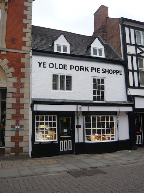
Melton Mowbray self proclaimed rural capital of food, is, of course renowned for its pork pies.
Maybe there will be another time. I hope so. Both of the Leicestershire towns I had visited had impressed me. I suspect that they are good places to live.
But I have no time to dawdle tomorrow it is 28 miles to Newark in Nottinghamshire. Having looked more carefully at the map this time I see that after an initial climb and steep descent the challenging up and down should be behind me, well for a while anyway.
Before I leave Melton though I intend to buy a pork pie at the ‘shoppe’ pictured for a picnic lunch.
29.05.14 UATW computer data:
Miles cycled: 31.67 miles (should have been 24)
Average speed: 9.2mph (I am surprised it is still over 9)
Cycling time: 3 hours 26 minutes.
Share This Post


I'm living well for nothing at all! (See: No Trifling Matter: Magpie Trapped in Godalming Sainsbury’s)


Next stop, Debt Chasm! (See: We Should All Be Outraged About the Failure to Deal with Legacy Debt)


Recent Comments