- Stay Connected

Socialize

 Abraham Lincoln
If given the truth, the people can be depended upon to meet any national crisis...
Abraham Lincoln
If given the truth, the people can be depended upon to meet any national crisis...

 Guildford news...
for Guildford people, brought to you by Guildford reporters - Guildford's own news service
Guildford news...
for Guildford people, brought to you by Guildford reporters - Guildford's own news service
Where Is This? No.250
Published on: 9 Mar, 2017
Updated on: 9 Mar, 2017
By David Rose
Excellent replies with lots of additional details relating to last week’s mystery vintage picture.
It was a view of North Street just down from its junction with Chertsey Street, taken some time before 1907 when a pub called the Crown was demolished.
Buildings of note seen in the picture that still stand today are what is now the Edinburgh Woollen Mill store, previously Clark’s College, before that Archbishop Abbot’s School and originally built as a manufactory when its benefactor Archbishop George Abbot had visions of reviving the town’s woollen trade. And also seen was the building that for many years was the Horse and Groom pub.
The wall in the quirky picture, as some correctly identified, can be found near Shalford Park. Chris Townsend did notice the lone concrete wartime tank trap in the view.
Let’s see how the regular regular readers fare with this week’s pair of images, and perhaps other readers may also leave a reply in the box below with their answers.
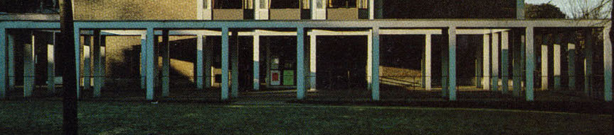
Do you recognise this building? Click to enlarge in a new window.
The vintage picture is heavily cropped from the overall photo of a town centre building that was opened in 1962 and which has now been replaced with a new version. Does that make sense? Can you work out what it was from the slim image seen here?
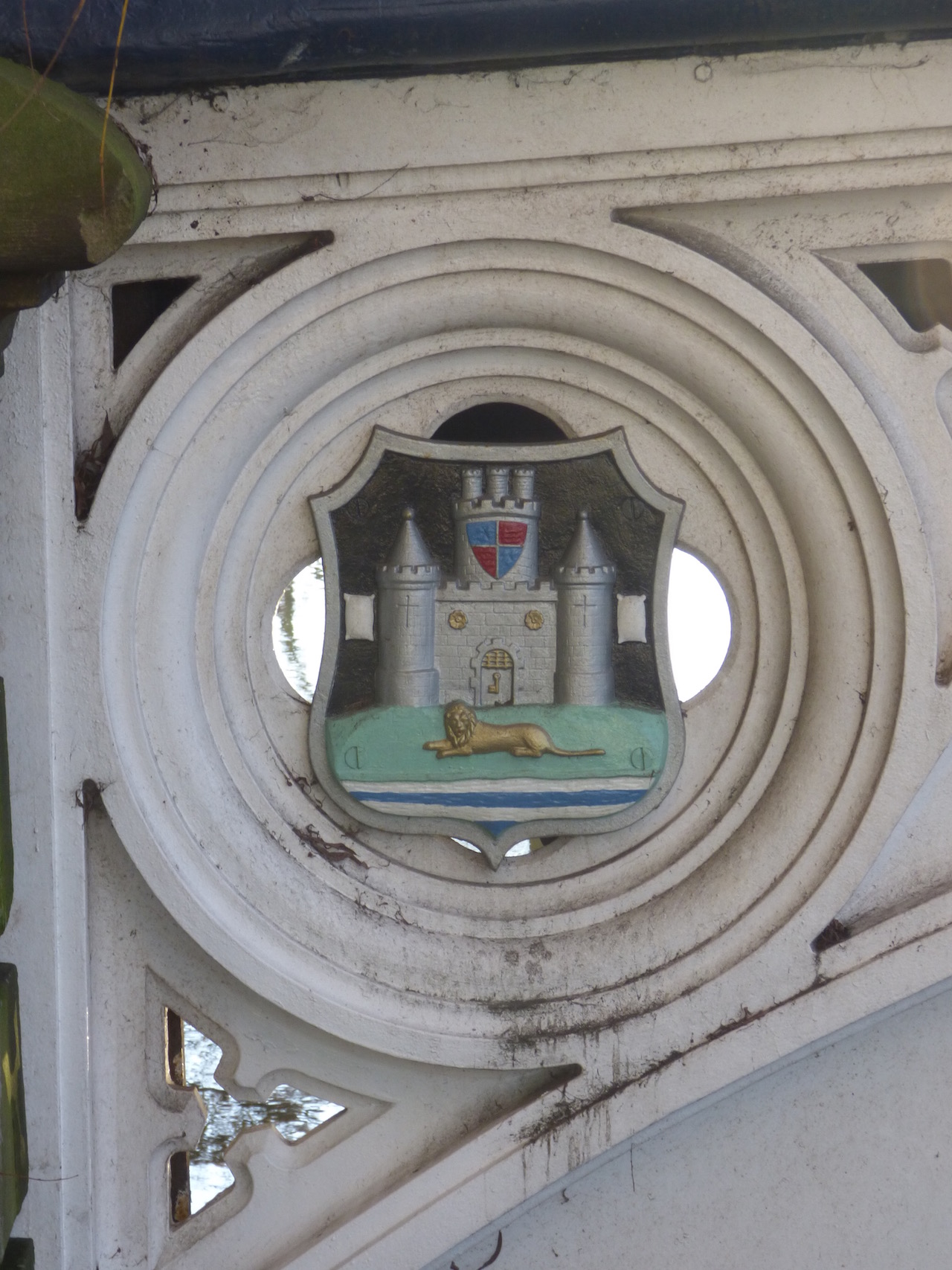
Do you know where this is? Click to enlarge in a new window.
This week’s quirky picture shows the town’s coat of arms within a structure in the town. What is it please?
If you think you know the answers, please leave a reply in the box below. The answers, along with the next pair of images, will be published at about the same time next week.
Share This Post


Responses to Where Is This? No.250
Leave a Comment Please see our comments policy. All comments are moderated and may take time to appear. Full names, or at least initial and surname, must be given.

I'm living well for nothing at all! (See: No Trifling Matter: Magpie Trapped in Godalming Sainsbury’s)


Next stop, Debt Chasm! (See: We Should All Be Outraged About the Failure to Deal with Legacy Debt)


Dave Middleton
March 9, 2017 at 11:09 pm
The building is the old and much loved Civic Hall. Why oh why didn’t they name the new building “The New Civic Hall”, which actually would’ve meant summat, rather than “G Live”, which means now’t.
The borough arms are on the Town Bridge.
Bernard Parke
March 10, 2017 at 7:20 am
1) Civic Hall
2) Town Bridge
John Lomas
March 10, 2017 at 4:14 pm
The “old” photo was Guildford Civic Hall now replace by G Live.
The quirky pic shows the bracing under the sides of the Town Bridge, presumably there a four of them and the one photographed is on the south side of the bridge and seen from the towpath.
Mike Williams
March 10, 2017 at 4:44 pm
That’s part of the old Civic Hall isn’t it ? And the town shield in a ring seems to be part of one of the town centre bridges over the river.
Charles Graham
March 10, 2017 at 7:41 pm
1. The old Civic Hall,
2. Onslow Bridge, Bridge Street.
Chris Townsend
March 12, 2017 at 5:55 pm
The vintage picture is of the entrance to the Civic Hall.
The borough arms are on the north side of the town bridge, viewed from the riverside near “The Bargeman”.
Margaret Cole
March 15, 2017 at 8:35 am
The first picture is the front of the Civic Hall or G Live.
Second one can be seen on the Town Bridge which has recently been painted was quite difficult to find but my tablet revealed location. easy peasy!
Bill and Doug Staniforth
March 16, 2017 at 8:46 am
Picture 1 is the old Bridge House on Bridge Street Coombes garage and petrol station were on ground level.
Picture 2 is the High Street bridge.
Two references to bridges over the river but still no prizes!