- Stay Connected

Socialize

 Abraham Lincoln
If given the truth, the people can be depended upon to meet any national crisis...
Abraham Lincoln
If given the truth, the people can be depended upon to meet any national crisis...

 Guildford news...
for Guildford people, brought to you by Guildford reporters - Guildford's own news service
Guildford news...
for Guildford people, brought to you by Guildford reporters - Guildford's own news service
Where Is This? No.252
Published on: 24 Mar, 2017
Updated on: 24 Mar, 2017
By David Rose
The picture of people enjoying a VJ Day party in August 1945 was indeed taken in Stoke Recreation Ground and from the Recreation Road side, with the former power station in Woodbridge Road in the background.
Dave Middleton supplied the quirky picture of iron rings set into a wall and now says: “They are set into the front boundary wall of Guildford Divisional Police Station, opposite the public reception office and date back to when the site was the cattle market.
“I was told by an old PC who is sadly no longer with us, that they were used to tie up bulls and the like, while they were waiting for auction.
Chris Townsend adds further details in her reply, so click here to see last week’s post and all the replies.
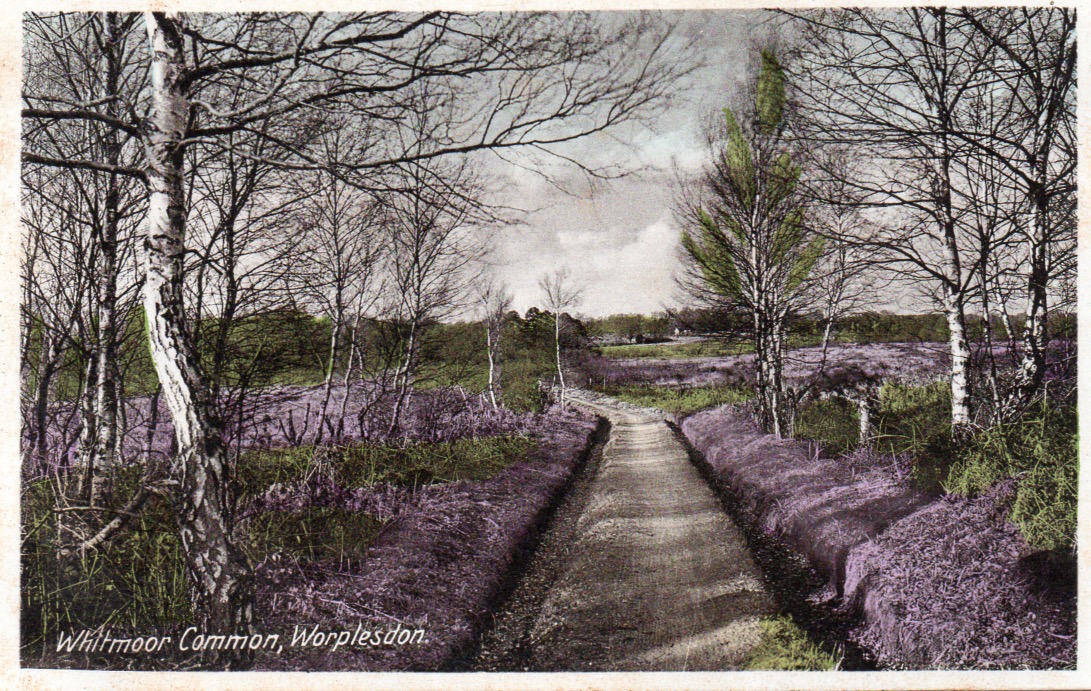
Do you recognise this footpath across Whitmoor Common? From which road does it lead from? Click to enlarge in a new window.
This week’s vintage picture is a picture postcard view of Whitmoor Common, Worplesdon. It may not be the most fascinating postcard image ever produced, but it shows what is still a well used footpath across the common.
The card dates to about the 1920s or 30s. The path, with a ditch either side, should be recognisable as it is much the same today, although the trees have grown considerably.
Do you know exactly where this view was taken from?
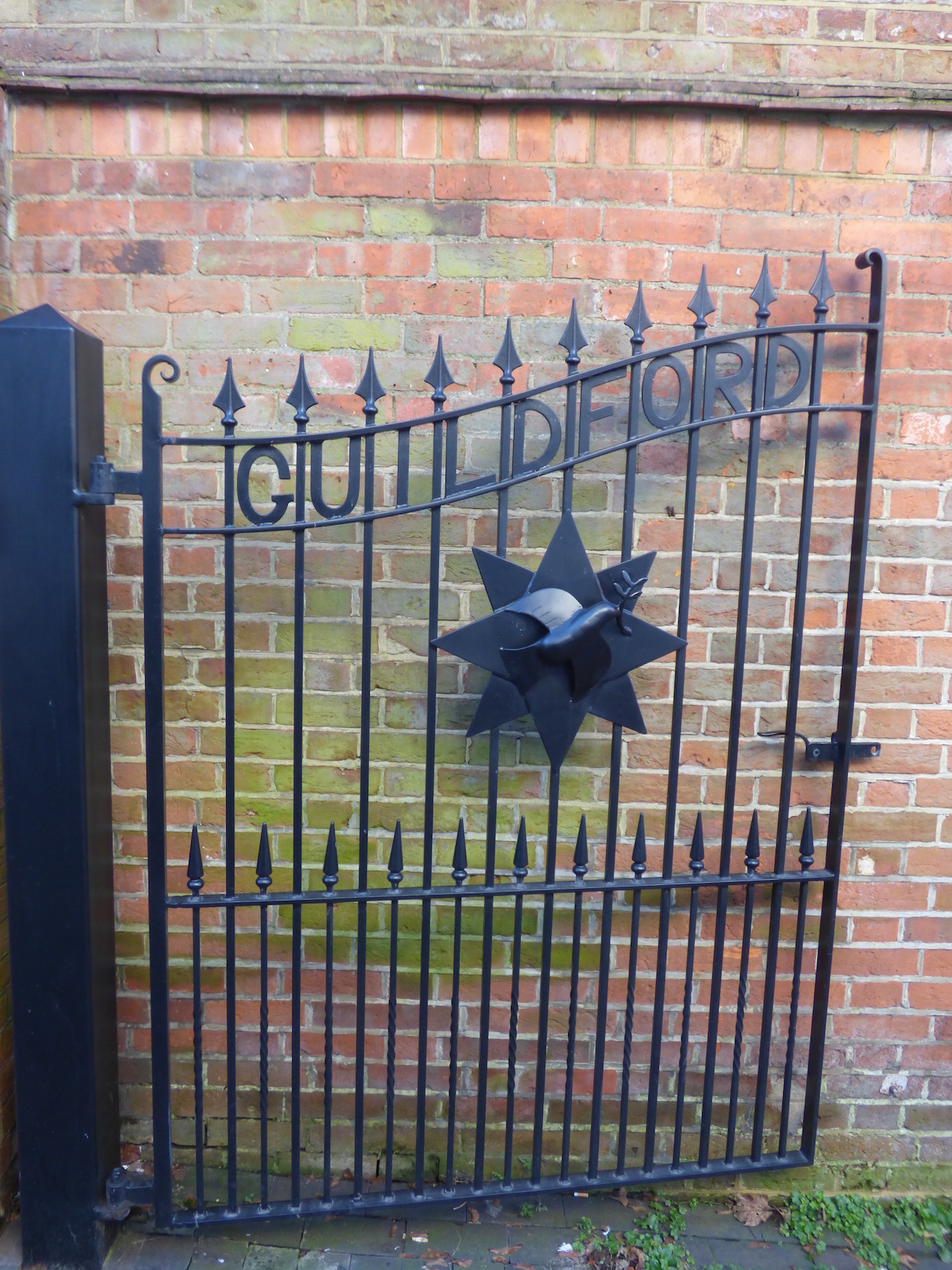
Do you know where this gate can be found?
This week’s quirky picture is a rather fine gate (one of a pair). It leads to a smallish building of some history in Guildford town centre. Do you know where?
If you think you know the answers, please leave a reply in the box below. The answers, along with the next pair of images, will be published at about the same time next week.
Share This Post


Responses to Where Is This? No.252
Leave a Comment Please see our comments policy. All comments are moderated and may take time to appear. Full names, or at least initial and surname, must be given.

I'm living well for nothing at all! (See: No Trifling Matter: Magpie Trapped in Godalming Sainsbury’s)


Next stop, Debt Chasm! (See: We Should All Be Outraged About the Failure to Deal with Legacy Debt)


Jackie Kay
March 25, 2017 at 4:32 pm
Quaker meeting House North Street
Dave Middleton
March 28, 2017 at 12:00 pm
The postcard view is of the path from Salt Box Road over the common. I’ve always known it as “The Long Path”, but I’ve no idea where I picked that up from. I’d say that the view was taken from the south end of the path, just about where the footpath from the roundabout at Salt Box Road / Worplesdon Road joins it from the west.
The gate is at the entrance to the Quaker meeting house on North Street, between the old fire station and the former Horse & Groom pub, opposite the library and Quaker’s Acre.
Chris Townsend
March 29, 2017 at 4:32 pm
The gate is at the North Street entrance to the Friends’ Meeting House; the pair say “Guildford Quakers”. (The dove in the design is a useful clue.)
John Lomas
March 31, 2017 at 7:44 pm
I don’t remember that footpath, we used to get to the common via a path behind the rifle range and then cross over Salt Box Rd. What I do remember from that area of the common was a big hole possible a sand pit or bomb crater (kids imagination probably)which we used to ride down the “cliff” side of on our pushbikes.