- Stay Connected

Socialize

 Abraham Lincoln
If given the truth, the people can be depended upon to meet any national crisis...
Abraham Lincoln
If given the truth, the people can be depended upon to meet any national crisis...

 Guildford news...
for Guildford people, brought to you by Guildford reporters - Guildford's own news service
Guildford news...
for Guildford people, brought to you by Guildford reporters - Guildford's own news service
SCC Reveals Its Management Strategy For Tackling Ash Vale Flooding Risk
Published on: 7 Nov, 2025
Updated on: 7 Nov, 2025
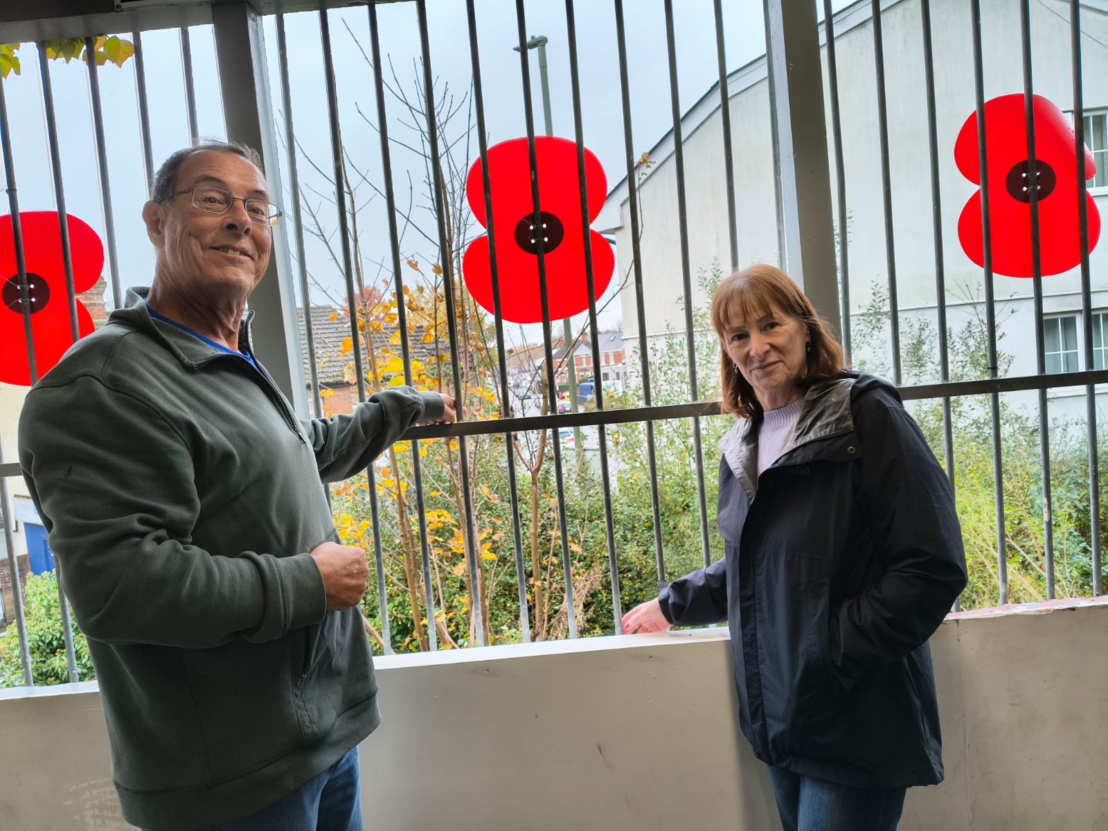
Councillors Richard Lucas and Carla Morson on the steps of Ash Vale Station, pointing out the route of the overflow sluice before the water goes into a culvert under the pedestrian crossing on Vale Road. There it joins the main surface water sewer running under Station Road East.
By David Reading
An experiment is under way to implement natural flood management features on the Ash military ranges to slow rainfall run-off and reduce the risk of a repeat of the flooding that occurred on the Avondale Estate, Ash Vale, in 2013.
Next summer Surrey County Council’s flood management team will be implementing natural management features such as scrapes – low lying areas that become temporary ponds – and leaky barriers in ditches in several different parts of the ranges.
Equipment will be installed to measure how much the various different features slow down the run-off and reduce the peak flow rate for a given amount of rainfall.
The Guildford Dragon gave an outline of the project in October but further details are now available.
The council says the key principles of the project are:
- Slow the flow: Using features such as leaky dams, tree planting, or contour ploughing to slow surface run-off and river flow.
- Store water: Creating ponds, wetlands, or reconnecting rivers with their floodplains to temporarily hold excess water.
- Infiltrate water: Increasing the soil’s ability to absorb rainfall through improved land management, reducing surface runoff.
- Protect and restore ecosystems: Restoring peatlands, woodlands, and meadows that naturally absorb and store water.
The council says this exercise will reduce the likelihood of flooding and also generate valuable knowledge to guide future natural flood management.
SCC says the benefits also include:
- Improved water quality
- Enhanced wildlife habitats
- Carbon storage and climate regulation
- Better drought resilience
The council held a consultation event in late October, in conjunction with Guildford Borough Council and Ash Parish Council. Around 50-60 people attended. Heavily involved in the project are Richard Lucas and Carla Morson, local ward councillors for Guildford Borough Council.
The area’s flooding problem is caused by the nature of the terrain.
The council points out that the Blackwater Valley is a steep sided, flat-bottomed valley that is a natural floodplain when significant rainfall occurs. Hills to the west (Caesar’s Camp), the south (the Hog’s Back) and the east (Normandy Hill, Ash Ranges ridge) channel rainfall run-off into the valley and Blackwater River, often via the Basingstoke Canal.
In 2013 there was significant flooding affecting houses on the Avondale Estate (Wellesley Close, Birch Way and Cypress Grove and surrounding areas) and further problems in Firacre Road.
In 2024 there were major flooding problems in the Lakeside area (Sopwith Close and Wellesley Place), although these have been ameliorated by the river clearance actions undertaken by Guildford Borough Council. Ward councillors Lucas and Morson were key figures in arranging the clearance.
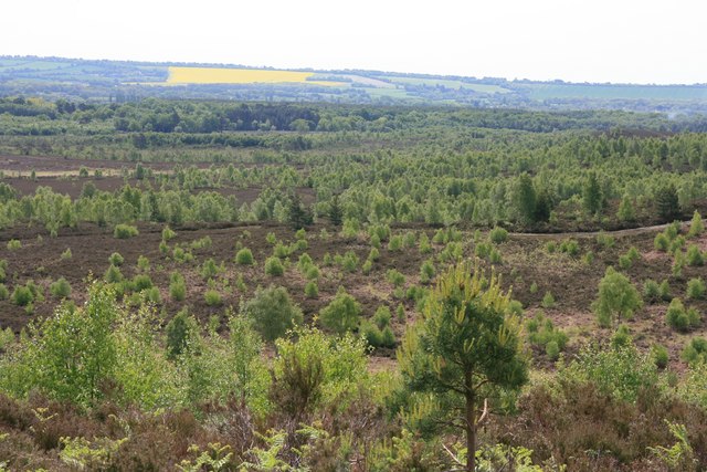
The Ash Ranges: rainfall runs from here and drains into the Basingstoke Canal
Much of the rainfall run-off from the Ash Ranges drains into the Basingstoke Canal. The overflow sluice from this section of the canal is by Ash Vale Station, and flows into the culvert under Vale Road and Station Road East.
From there it turns north and then drains into the Blackwater River near North Camp Station. The canal overflow route predates Ash Vale.
In the event of excessive rainfall, the Blackwater River level surges. The peak flow rate into the Station Road East culvert coincides with reduced drainage into the river. This is what led to the 2013 flooding.
The parties involved in the project are Guildford Borough Council, Surrey County Council and the Defence Infrastructure Organisation, who manage the military ranges.
Share This Post


I'm living well for nothing at all! (See: No Trifling Matter: Magpie Trapped in Godalming Sainsbury’s)


Next stop, Debt Chasm! (See: We Should All Be Outraged About the Failure to Deal with Legacy Debt)


Recent Comments