- Stay Connected

Socialize

 Abraham Lincoln
If given the truth, the people can be depended upon to meet any national crisis...
Abraham Lincoln
If given the truth, the people can be depended upon to meet any national crisis...

 Guildford news...
for Guildford people, brought to you by Guildford reporters - Guildford's own news service
Guildford news...
for Guildford people, brought to you by Guildford reporters - Guildford's own news service
Tumbling Bay’s Original Use And Why The Mill Stream Could Date To Saxon Times
Published on: 10 Nov, 2019
Updated on: 12 Nov, 2019
The collapse of the Tumbling Bay weir at Millmead in Guildford and the unusual sight of a trickle of water on some stretches of the navigation towards St Catherine’s has led to questions about the age of the weir and also that part of the waterway.
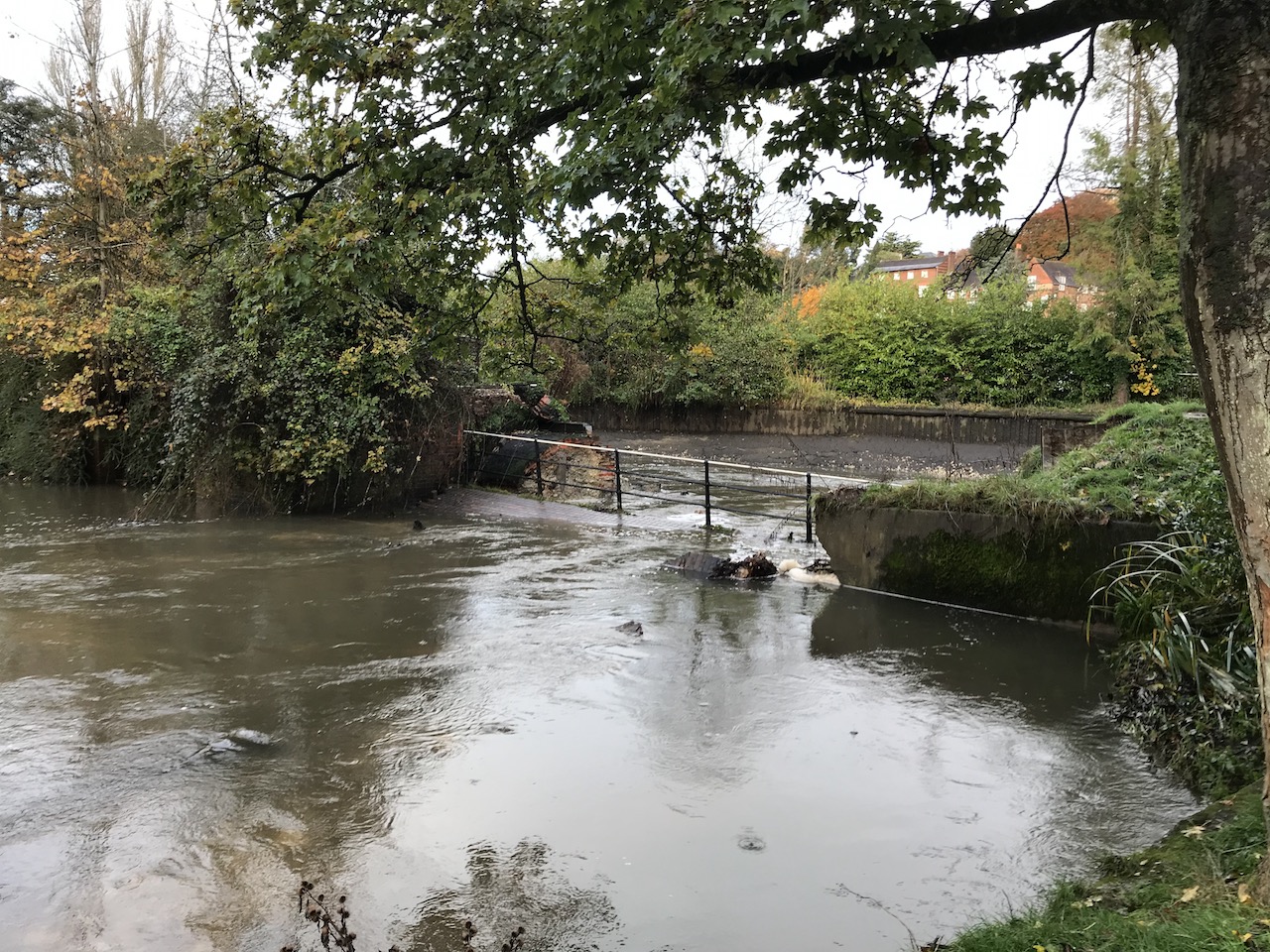
The Tumbling Bay weir washed away. Photographed on Monday, November 4, 2019. Click on all pictures to enlarge.
It may come as a surprise to learn that it is likely man has been ‘altering’ the course of the River Wey for good reasons as far back as Saxon times!
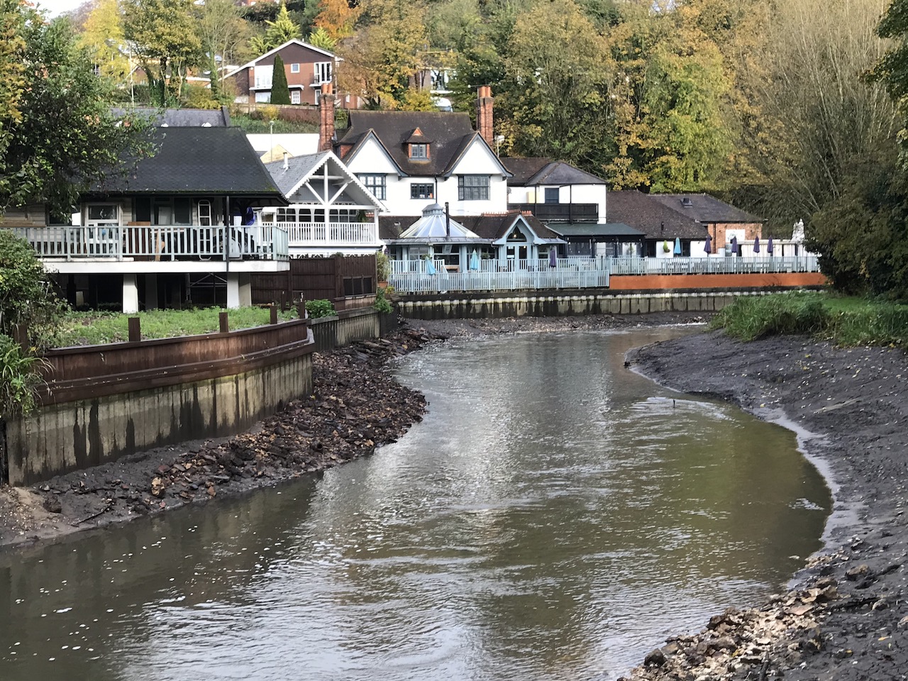
The Godalming Navigation looking towards the Weyside pub, Guildford, on November 4, 2019, with a much reduced flow of water.
Here, eminent local historian Dr Mary Alexander, formerly collections officer at Guildford Museum, explains what Tumbling Bay was original created for and gives good evidence of the natural river being physically altered over the centuries and for what purposes.
First, a brief recap on the history of today’s Wey Navigations, managed by the National Trust, to which the waterway was gifted in 1964 by its previous owners the Stevens family.

Sir Richard Weston.
The waterway from Millmead Lock going upstream to Godalming is the Godalming Navigation. It is, of course, linked to the River Wey Navigation that flows downstream from Millmead to Weybridge where it meets the Thames.
The navigation from Weybridge to Guildford was opened in 1653 to carry cargo and was the brainchild of Sir Richard Weston of Sutton Place. It is one of the earliest rivers in Britain to be made navigable. Its creators utilised navigable stretches of the river where possible, digging canals (or cuts) where elsewhere required.
By the 1720s it carried an average of 17,000 tons of produce per year, generating about £2,000 revenue by its tolls. Later, the navigation was extended from Guildford, past St Catherine’s, to reach Godalming in 1764.
Now Dr Mary Alexander writes about her observations:
The tumbling bay on the river at Guildford is a remnant of an old system of getting boats from the upper level of a river to a lower one (and vice versa) usually where a channel had been made at a higher level to take water to a mill.
Early locks had only one gate, at the top, and to get to the lower level the gate was opened and the boat rushed (or tumbled) through on the flood.
The tumbling bay is shown on the 1739 map of Guildford called the Ichnography, and called the Rowling Bay.
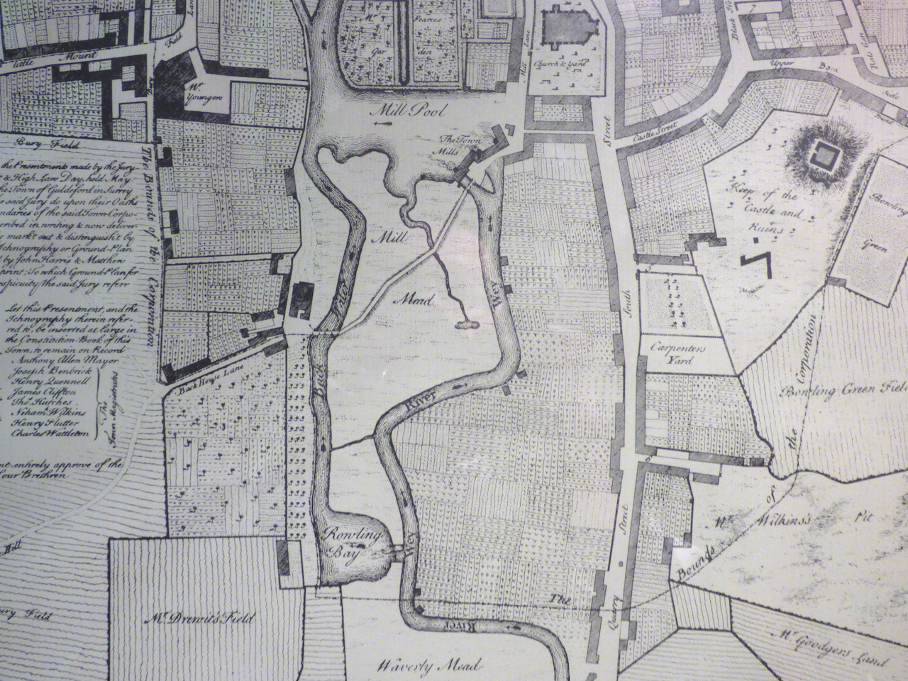
A section of the 1739 map of Guildford called the Ichnography. ‘Rowling Bay’ (now known as Tumbling Bay) is marked and can be seen towards the bottom in the centre. Notice ‘The Town Mills’ are marked at the top. The ‘Keep of the Castle and Ruins’ are marked to the top right. The names given to other fields, yards and parcels of land are well worth studying too!
It was clearly where boats on the river upstream of the mill could get to the natural course of the river, avoiding the mill.
In 1764 the Godalming Navigation opened, with improvements to the course of the natural river between Guildford and Godalming.
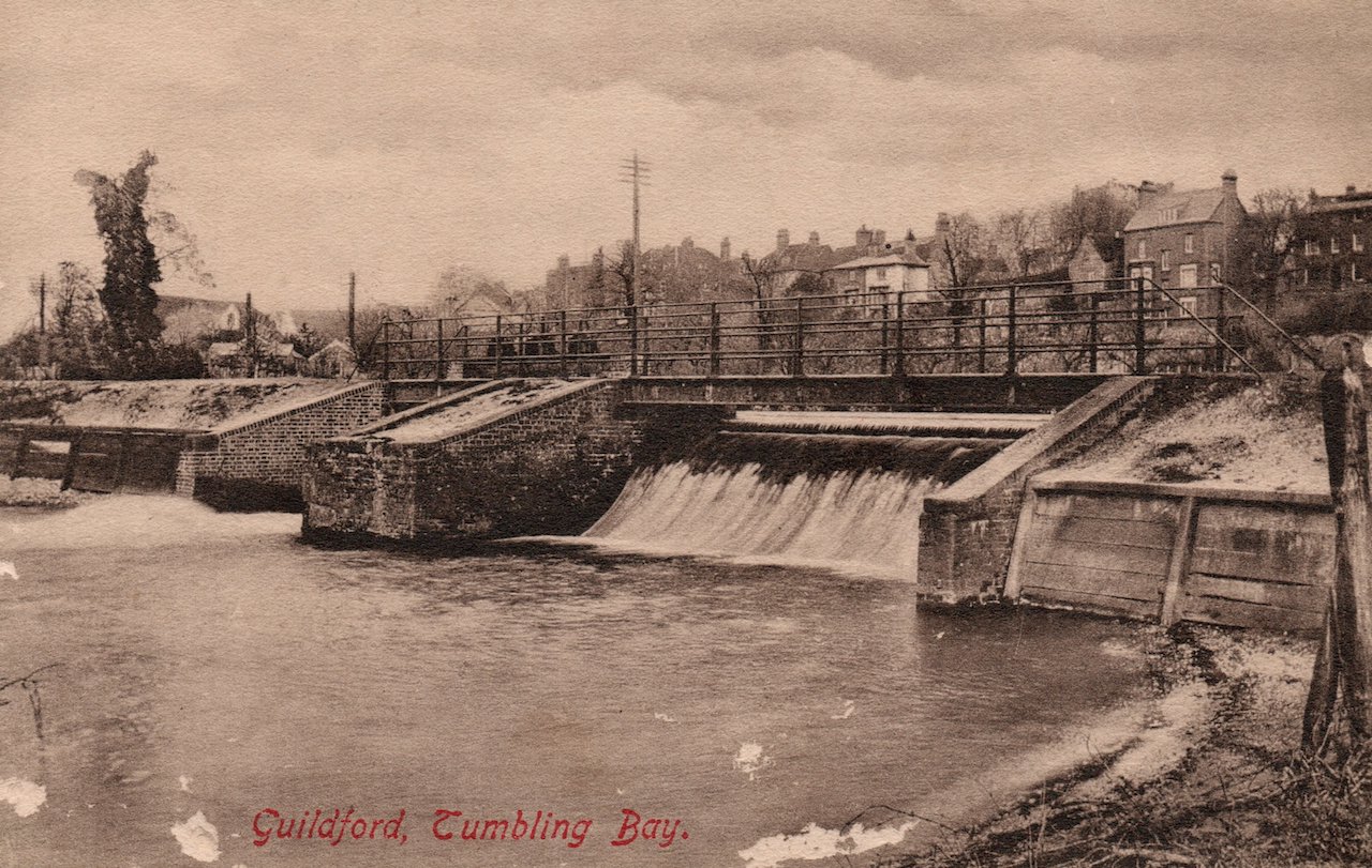
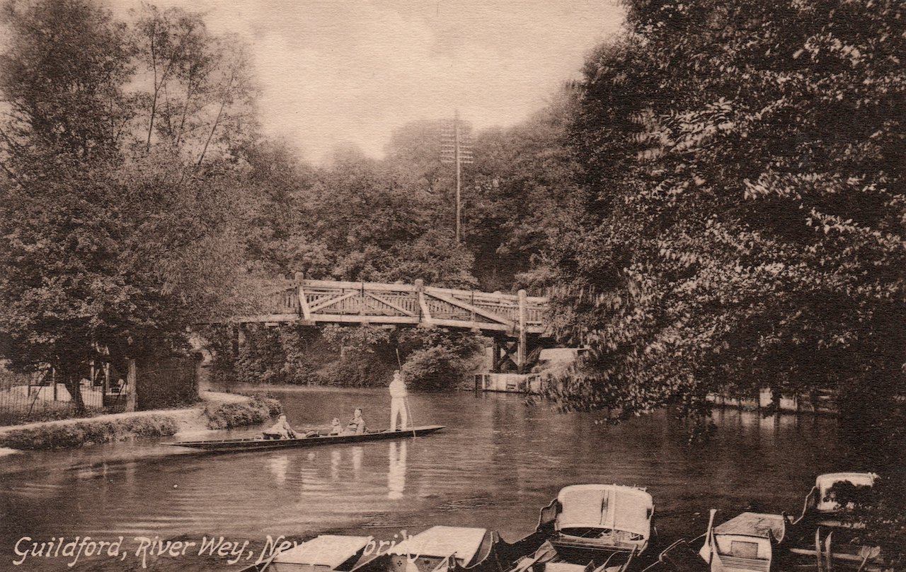
A picture postcard view of Tumbling Bay in the 1900s. David Rose Collection.
The Rowling Bay of 1739 shows that boats were already using the river, but after 1764 it would have been much easier. The Tumbling Bay now presumably regulates the flow of water along this stretch.
The natural course of the river is clearly at the lowest point of the land. A stream runs across Shalford Meadows, which must mark the natural course of the river.
A 1900s picture postcard view taken from Guildford Rowing Club looking downstream when it was a wooden footbridge that spanned the river here linking the towpath to Shalford Road. David Rose Collection.
It flows under the embanked stream near Guildford Rowing Club, and joins the natural river at the pool formed below the tumbling bay.
There is also a small weir letting water into this stream from the embanked section, with a bridge across it.
The embanked stream is clearly taking water to the Town Mill [adjacent to today’s Yvonne Arnnaud Theatre].
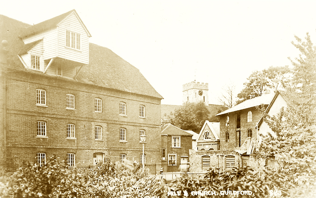
Guildford’s Town Mill pictured in the early 20th century. David Rose collection.
The mill site is definitely medieval and could be Anglo-Saxon. The embankment starts as far upstream as St Catherine’s Hill, where the river flows up against the hill and on the edge of the alluvium.
Further upstream, the natural river flows a very meandering course past Shalford, but a straighter channel was cut to bypass it for the Godalming Navigation.
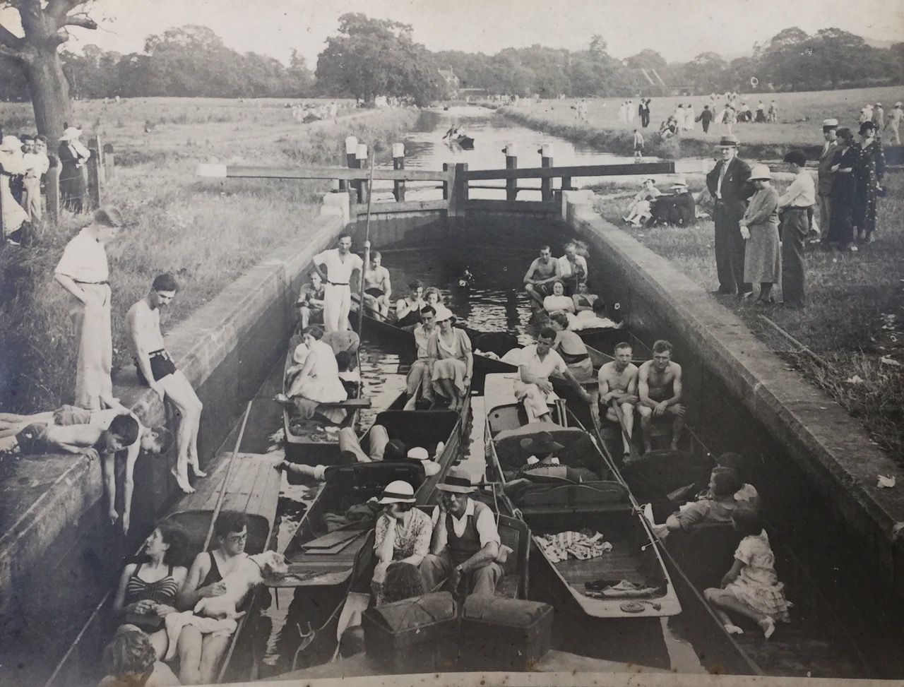
The straight ‘cut’ at St Catherine’s Lock on the Godalming Navigation. Photographed by Bill Dennett in what looks like the 1930s.
There were two other cuts at Unstead and Catteshall, but not at St Catherine’s, which must have been a satisfactory channel already.
So when was this stretch [St Catherine’s to Millmead] embanked? As it provides a head of water for the mill, it must be of the same date, and therefore could be as early as Saxon times.
However, we have very little information before the 18th century, so we must be cautious.
Large scale water-works are known from Saxon times, so there is no reason why the mill stream could not be Saxon, but we don’t know what alterations may have been made in the following centuries.
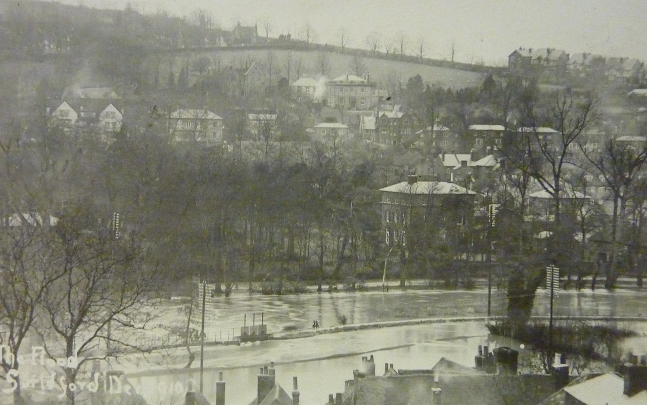
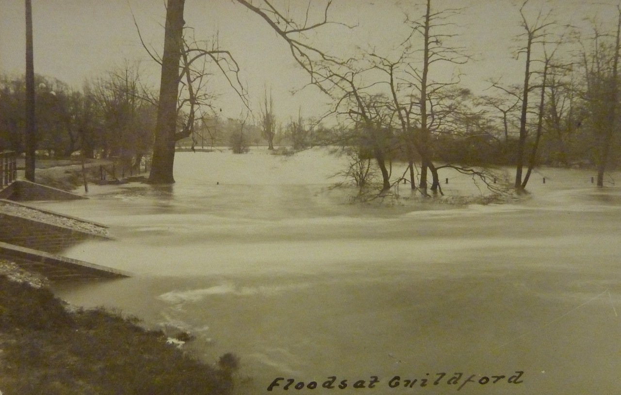
Water, water everywhere! Viewed from Quarry Street, Tumbling Bay in the floods of 1910. David Rose collection.
The parish boundary between St Mary’s and St Nicolas follows the natural river from the Town Bridge south, then turns up the tumbling bay and along the mill stream.
This suggests that the mill stream is very old, since parish boundaries were being fixed in the 11th and 12th centuries, but probably earlier at Guildford.
Guildford was established as a planned town in the mid-10th century and the parish boundaries were probably defined then.
The boundary continues south, dividing Shalford from Artington, along the embanked stretch then returning to the natural river.
And flooded again in 1925. David Rose collection.
Share This Post


Responses to Tumbling Bay’s Original Use And Why The Mill Stream Could Date To Saxon Times
Leave a Comment Please see our comments policy. All comments are moderated and may take time to appear. Full names, or at least initial and surname, must be given.

I'm living well for nothing at all! (See: No Trifling Matter: Magpie Trapped in Godalming Sainsbury’s)


Next stop, Debt Chasm! (See: We Should All Be Outraged About the Failure to Deal with Legacy Debt)


Eric Brough
June 25, 2024 at 6:17 pm
The town mill lies on the east side of the River Wey. The feeder stream is taken off the Wey on the west side and then has to cross the valley on an embankment near the rowing club. I’ve always wondered why the Anglo-Saxons would choose to do this. Why not dig the feeder channel down the east side of the valley? Is it possible that there was once a mill on the west side that was originally fed from the St Catherine’s area?
Editor’s comment: The historical management of the Wey raises several questions. Mills are believed to have been operating in the town from before the conquest and would have required headwater of sufficent depth and flow. If the existing embankment on the west of Shalford Meadow was created in Saxon times to achieve this, does it have unusual historical significance which should be recognised? As for a mill on the west bank of the river, the Guildford Heritage website states: “The first recorded Guildford Mill stood on an island where the White House Pub stands today.”