- Stay Connected

Socialize

 Abraham Lincoln
If given the truth, the people can be depended upon to meet any national crisis...
Abraham Lincoln
If given the truth, the people can be depended upon to meet any national crisis...

 Guildford news...
for Guildford people, brought to you by Guildford reporters - Guildford's own news service
Guildford news...
for Guildford people, brought to you by Guildford reporters - Guildford's own news service
Where Is This? No.283
Published on: 13 Jan, 2018
Updated on: 13 Jan, 2018
By David Rose
Most readers who replied to the previous post correctly identified the vintage picture as being Denzil Road.
The Stanniforth Brothers claimed it is named after Denzil Tulser. He, of course, was a character in the TV comedy Only Fools and Horses.
You may be able to fool some of people all of the time, but not us!
So who was Denzil? According to Wikipedia (if you feel inclined to believe it): “Denzil Onslow of Stoughton (c. 1698 – 15 November 1765) was a British politician. A member of the influential Onslow family of Surrey. He held a number of lucrative Government posts, and died owing a relatively large sum to the Treasury through mismanagement of his accounts.”
In her reply, Carol Norris asked of the origin of Genyn Road, that adjoins Denzil Road.
In her book, Guildford’s Hidden History, author Helen Chapman Davies, lists the keepers of Guildford’s enclosed royal deer park, and in and around 1422 John Genyn was the keeper.
The war memorial in the quirky picture can be found on Blackheath.
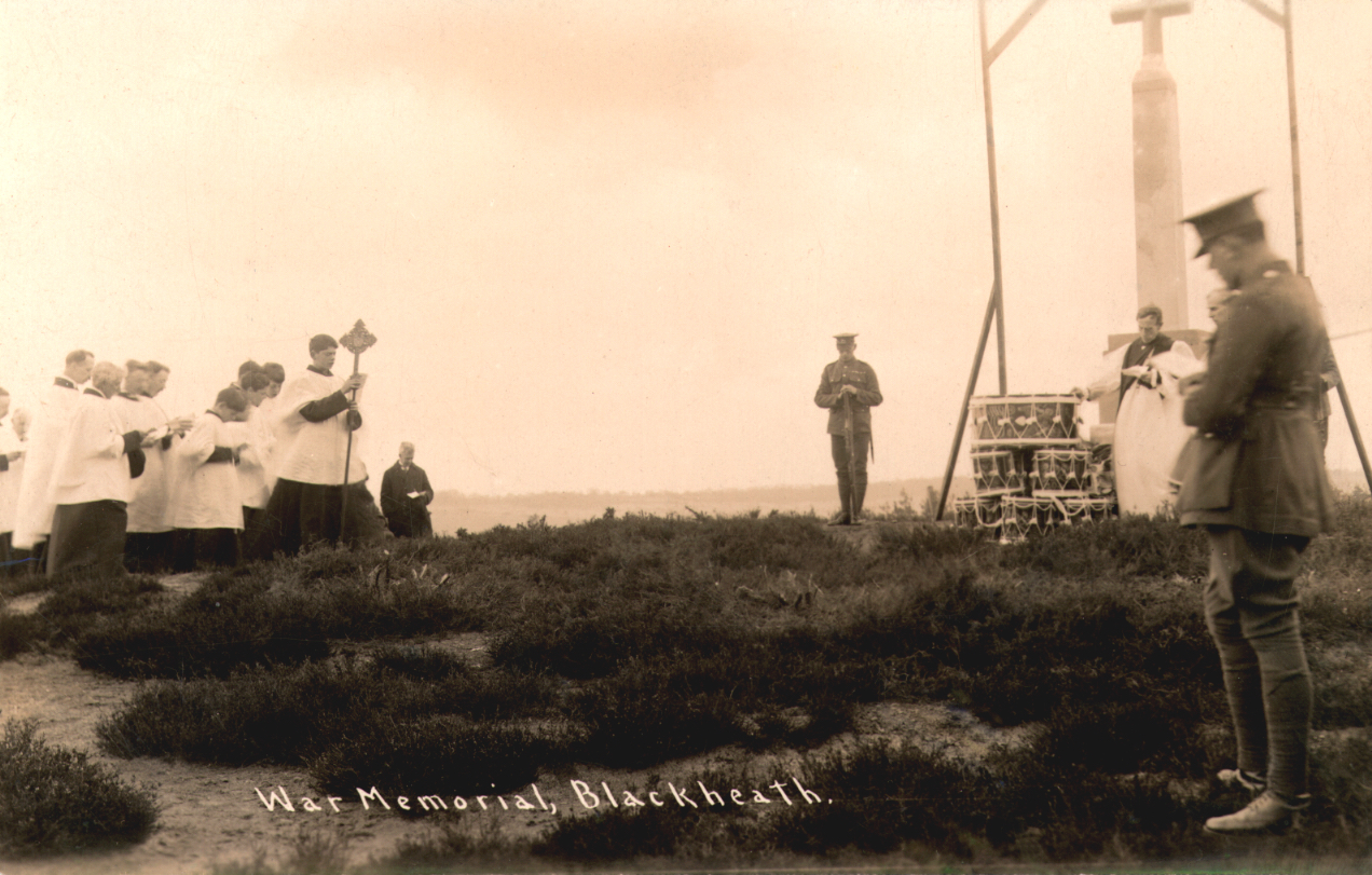
The war memorial at Blackheath. Perhaps the unveiling and dedication ceremony? Click to enlarge pictures in a new window.
Here is a picture postcard of it. I wonder whether this was taken at the unveiling and dedication of it?
Click here to seer the previous post and all the replies.
Two pictures as the mystery vintage ones this week. Both taken from a high vantage point over looking Guildford town centre.
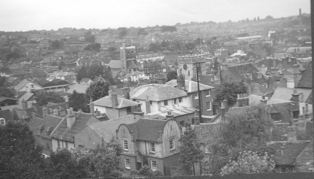
Vintage picture 1.
They were sent to me by Julia Funnell. Her late father-in-law took the photos and I guess they date to around the end of the 1950s.
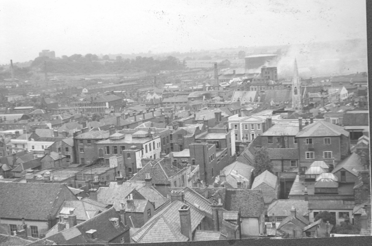
Vintage picture 2.
Do you know from where he took the pictures and can you name some of the buildings seen, particularly ones that no longer exist or have changed in appearance.
I am particularly interested in the house with the curved features of the upper walls and roof seen in picture 1. It is much altered today. Who occupies it now?
If you use Google Earth, you can zoom in and almost get the same angle today.
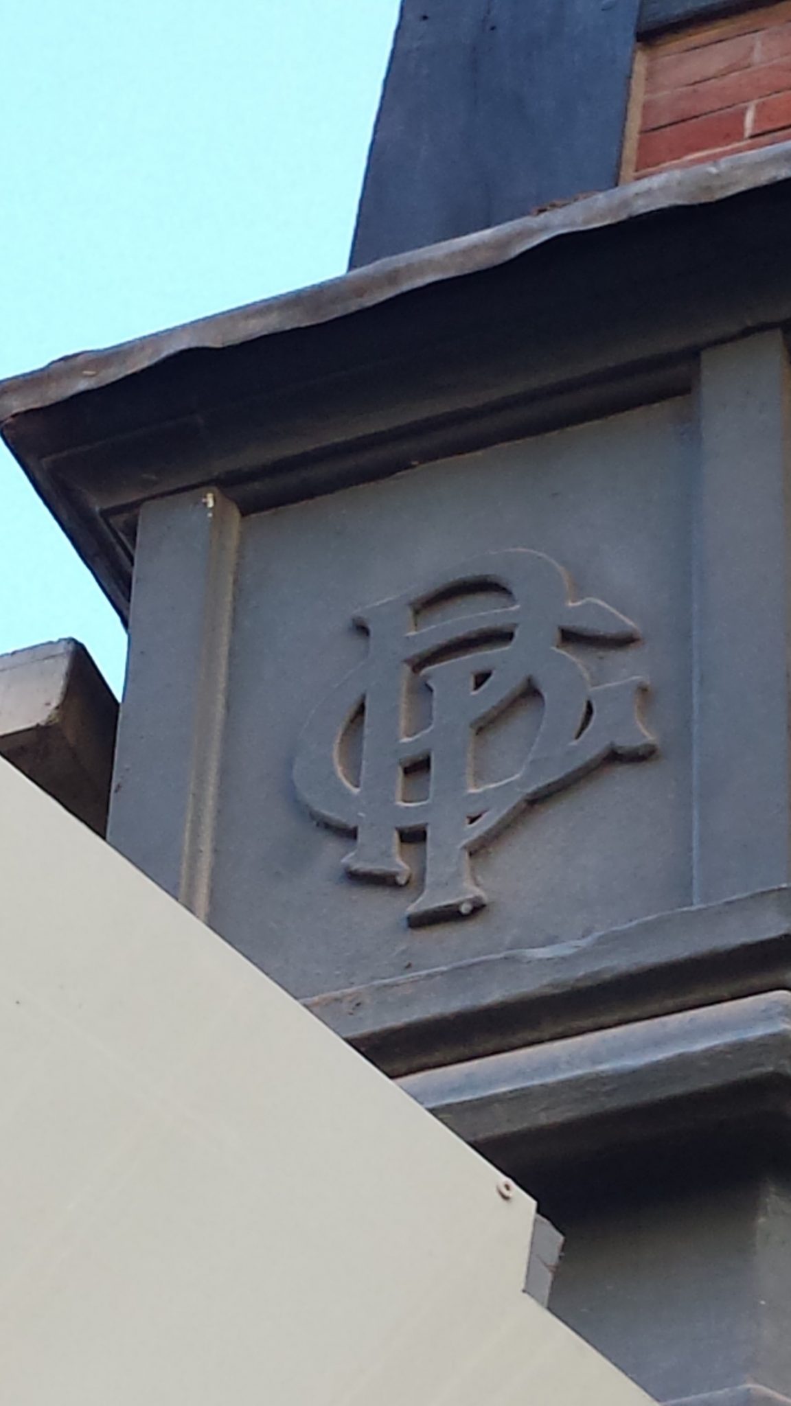
Quirky picture 1.
This week’s quirky pictures were submitted by Dave Middleton, who has sent some good ones in before.
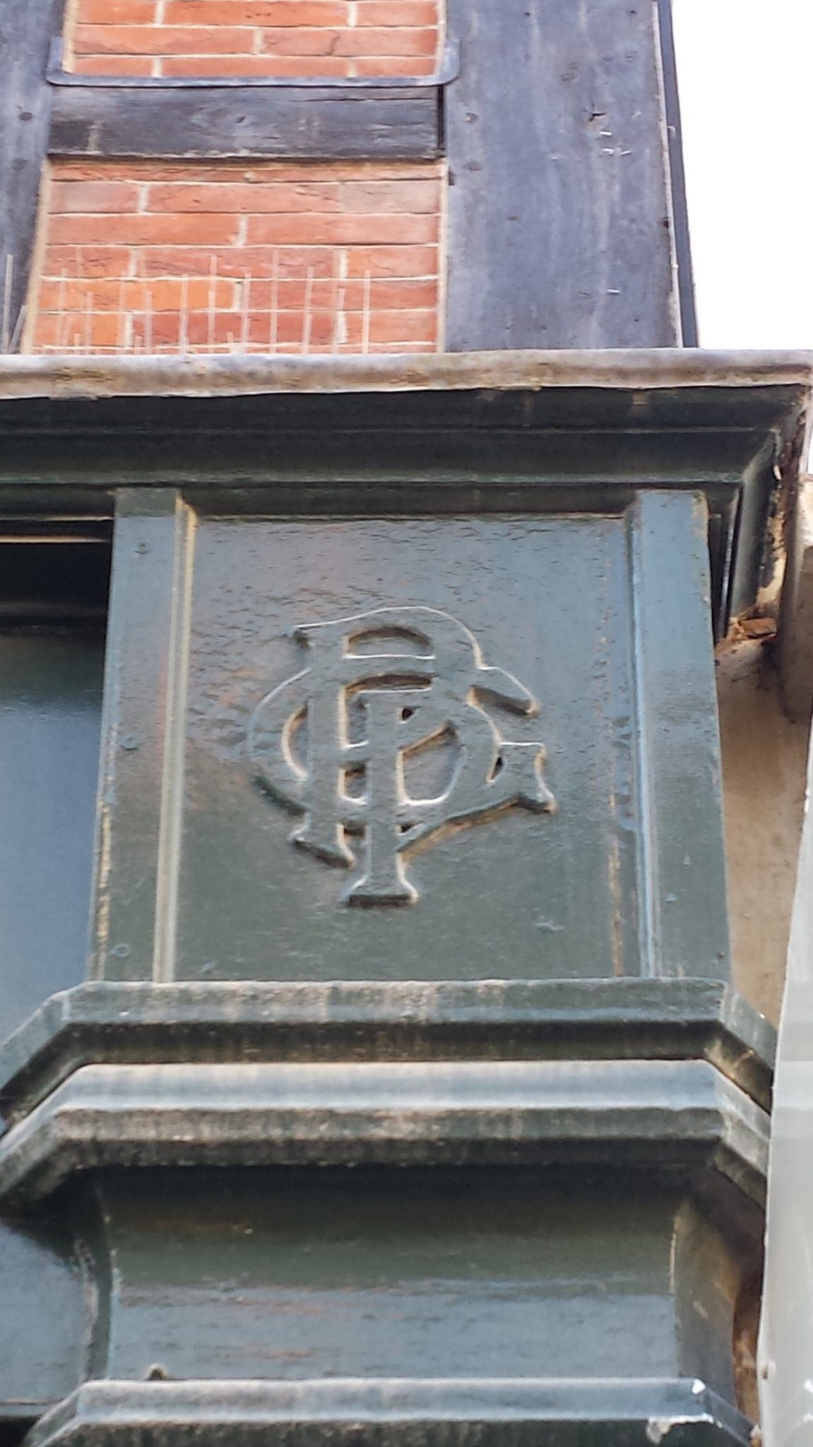
Quirky picture 2.
They are a bit tricky, and I had not noticed this monogram before. Dave says: “They show some wooden initials on the fascia of two shops in Guildford High Street.”
Do you recognise the location and perhaps know whose monogram is featured?
If you know the answers and perhaps can add some more details, please leave a reply in the box below. I’ll give the answers in two week’s time with the next two images.
Share This Post


Responses to Where Is This? No.283
Leave a Comment Please see our comments policy. All comments are moderated and may take time to appear. Full names, or at least initial and surname, must be given.

I'm living well for nothing at all! (See: No Trifling Matter: Magpie Trapped in Godalming Sainsbury’s)


Next stop, Debt Chasm! (See: We Should All Be Outraged About the Failure to Deal with Legacy Debt)


Colin Alderman
January 13, 2018 at 4:53 pm
The first picture feature roofs of 55-56 Quarry Street which were used as offices for some 200 odd years, and from 1934 to 1970 the offices of Barlow, Norris & Jenkins solicitors, then Barlow followed by Barlow Robbins until five years ago.
Before 1934 it was used by the founders of Barlows.
Steve Grove
January 13, 2018 at 8:06 pm
Picture 1, taken I would think from the top of the Castle Keep.
St Mary’s Church is slightly right of centre and St Nicolas Church slightly left of centre.
The tall chimney in the top right corner is that of the Friary Brewery.
Picture 2, taken I think from the top roof top garden of Harvey’s (now House of Fraser) looking towards the Friary Brewery with the Congregational Church (long since gone and currently Barclays Bank in North Street).
The old gasometer is behind the brewery. Top left is the cathedral under construction.
The quirky pictures are the initials of the Guildford Picture Palace now the entrance to Tunsgate Arcade and hopefully to be retained when the new centre opens.
Russell Morris
January 15, 2018 at 1:05 pm
The two vintage pictures are from the top of the Castle Keep.
The first, looking approximately north west, shows 39 Castle Street (Guildford Volunteer Centre) in the foreground with it original semicircular gable parapets.
No idea why these delightful Arts and Crafts features were stripped from the building. Perhaps the parapets had become dangerous or were creating an entry point for damp.
The second picture is slightly closer towards the north. The outline of Guildford Cathedral, still without its tower, can be seen on the horizon.
The modern pictures show the shop fascia boards flanking the entrance to Guildford Picture Playhouse – thus GPP.
The original arcade that led to the Playhouse was demolished when Tunsgate Square was formed.
The Plahouse, arcade and flanking Tudoresque shops were designed by local architect FJ Hodgson 1919.
Original perspective views of the scheme, drawn by D Hucker can be viewed on the internet.
The Playhouse was opened in 1922 with a simpler and slightly less glamorous entrance than that show on the perspective.
John Lomas
January 15, 2018 at 5:57 pm
The old pictures appear to have been taken from the west side or north-east corner of the castle mound.
I think the building with the Dutch gables is the one on Castle Street that now houses Voluntary Action South West Surrey and the gables have been rebuilt as conventional ones.
Immediately above that is a building on Quarry Street which has a distinctive flat/sunken area in the centre of its pitched roof.
The distinctive building on the other photo, with a “Regency Grecian?” gable looks to be what Streetview shows as Boots.
The church to the right and behind that is probably the old Methodist Church on the corner of Woodbridge Road and North Street.
The quirky pics are on the shops of Clarks and TM Lewin.
Surely the monogram is GPP – Guildford Picture Playhouse the arcade entrance to which was between the two shops.
http://photos.cinematreasures.org/production/photos/180511/1473583918/large.jpg?1473583918
Mary Alexander
January 15, 2018 at 6:57 pm
Quirky pictures: the initials are Guildford Picture Palace at the beginning of the arcade now known as Tunsgate Arcade.
I’ve kept an eye on these and it looks as if they will be retained – I hope so.
The arcade was built after a fire at Cable Reeks shop.
Mike Dillon
January 16, 2018 at 4:10 pm
The first vintage photo looks towards the river and shows St Mary’s and St Nicolas churches with part of the Mount in the background.
The second vintage photo is towards Stag Hill and shows the old Methodist Church on the corner of North Street and Woodbridge Road, the Gas Works with the smoke riseing
and also the partly built cathedral, top left
I would guess that the photos were taken from the keep at the top of Guildford Castle.
John Thorp
January 17, 2018 at 10:53 pm
The columns are on either side of what was Tunsgate Arcade. Goodness knows what it will be called when it reopens.
I think that the initials stand for Guildford Picture Palace as there was a cinema at the end of the short arcade before Tunsgate Square was built.
I feel very sorry for Clark’s shoe shop which has been forced to close due to flooding two or three times while the development has gone on. I do hope that they can return when it is finished.
Chris Townsend
January 26, 2018 at 7:26 am
The old photos were probably taken from the castle.
The first one has Castle Street in the foreground, with what is now Salter’s easily recognisable, next to the curvy house occupied by Voluntary Action South West Surrey today, number 39.
The backs of houses in Quarry Street are seen at an angle across the centre, with St Mary’s Church beyond. To the left of that in the photo is St Nicolas Church, with trees in the churchyard before the building of the St Nicolas’ Community Centre.
The Greyhound pub (as it was then) is to its right. Centre left is John Moon’s timber yard, where Debenham’s is today. I can spot the chalk face beside the entrance to the railway tunnel, and to the right the old Royal Surrey County Hospital. Could that be the Railway Hotel, just below the plume of smoke (from a steam train?), with the long building the goods shed? I think the chimney belongs to the brickworks.
The second old photo shows the buildings on the corners of Chapel Street in the foreground, looking towards the High Street across the centre and the distinctive Boot’s shop (Marks & Spencer’s as it was then). The Lion Hotel is centre left. The Methodist Church has since gone, the Cinema, the Friary Brewery and the gas works, but Rodboro Buildings remains, and the old Electricity Works, the Plaza (as it was) and Billings’.
It’s good to see those views, with so many fields and trees, and the cathedral in an unspoiled setting.
The monograms are either side of the High Street entrance to the Tunsgate Square Shopping Centre, formerly the Playhouse Arcade.
The letters stand for Guildford Picture Playhouse. I remember queuing along the Playhouse Arcade for ages to watch “Lady and the Tramp” when it was first shown in Guildford.